
Mine Surveying in South Africa: Technology, Accuracy and Modern Mining Solutions
Contact OPTRON to find out more about our complete range of Drone solutions!
In this guide, we explore the role of surveying in mining operations, why accuracy and compliance matter in South African mining operations, and the technologies surveyors rely on. We also examine how OPTRON supports mining professionals with advanced Trimble mine surveying solutions.
What Is Mine Surveying and Why Does It Matter?
Mine surveying involves measuring and mapping mining environments to provide the spatial data required for excavation, infrastructure development and long-term planning.
Surveyors establish control networks and maintain measurement records throughout the life of a mining project. These measurements ensure excavation follows engineering designs, supports safe working conditions and meets regulatory requirements.
High levels of measurement accuracy are essential in mining, as even small positional errors can affect excavation direction, infrastructure placement and operational safety.
The Role of a Mine Surveyor
Mine surveyors combine technical expertise with modern equipment to manage spatial data across complex mining environments. This ensures that mining activities remain aligned with design plans and operational requirements.
Surveyors typically focus on several core responsibilities, including:
-
Establishing Survey Control: Creating reference points that guide measurements across the mine.
-
Mapping Underground Infrastructure: Recording tunnels, shafts and stopes as excavation progresses.
-
Monitoring Ground Movement: Detecting deformation or subsidence that could affect structural stability.
This survey data provides engineers and planners with the information to make informed decisions, maintain alignment with designs and respond to changes within the mining environment.
How Survey Data Supports Mining Operations
Survey data support both daily mining activities and long-term planning through:
-
Excavation Planning: Survey measurements ensure tunnels, shafts and stopes follow their intended directions.
-
Equipment Positioning: Accurate layouts guide drilling, blasting and machinery placement.
-
Operational Safety: Regular survey monitoring helps identify potential risks before they develop into structural problems.
Reliable survey data enable mining teams to plan excavations accurately, position equipment correctly and maintain safe, compliant operations.
Types of Mine Surveying Methods
Surveying techniques vary depending on mining activity and operational environment. Both surface and underground operations rely on specialised methods to maintain spatial accuracy.
Surface Surveying in Mining
Surface mines, including open-pit operations, rely on large-scale positioning systems to map terrain and infrastructure. GNSS (Global Navigation Satellite System) receivers allow surveyors to capture coordinates across wide areas, supporting activities such as pit design and haul road planning.
Underground Surveying
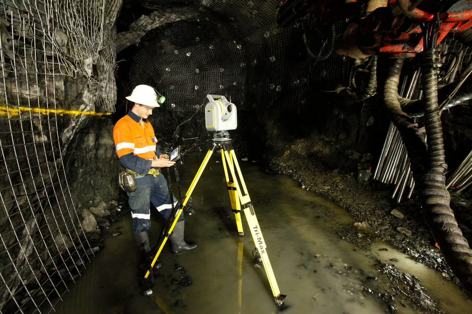
Underground operations require specialised surveying techniques because tunnels restrict visibility, and satellite signals cannot be used. Surveyors rely on precision instruments such as Trimble total stations to maintain accurate tunnel alignment and control networks.
Deformation and Monitoring Surveys
Monitoring surveys track ground movement within the mine. These measurements help identify subsidence, structural shifts or geological instability so engineers can respond quickly.
Technology Used in Modern Mine Surveying
Modern mining operations, including those across South Africa’s mining sector, depend on surveying instruments and software to capture accurate spatial data and support planning, monitoring and operational safety.

1. Trimble Total Stations for High-Precision Measurements
Trimble total stations remain one of the most widely used instruments in mine operations. Solutions such as the Trimble SX12 Scanning Total Station combine high-precision measurement with integrated 3D scanning, allowing surveyors to capture detailed spatial data in both surface and underground environments.
2. GNSS Positioning Systems
GNSS technology allows surveyors to capture accurate positioning data across surface mines. These receivers establish survey control networks and map infrastructure across large sites.
3. Laser Scanning and 3D Mine Mapping
Laser scanning technology captures millions of measurement points to create detailed three-dimensional models of mining environments.
These digital models allow engineers and planners to visualise underground structures and assess excavation progress more effectively.
Comparison of Mine Surveying Technologies
Different surveying systems perform specific measurement functions across surface and underground operations. Understanding how each system is applied helps survey teams select the appropriate equipment for different operational tasks.
The table below summarises their primary functions and typical applications:
| Survey Technology | Primary Survey Function | Typical Mining Application |
|---|---|---|
| Trimble Total Stations | High-precision coordinate measurement | Underground tunnel layout and monitoring |
| GNSS Receivers | Large-area positioning | Surface mapping and control networks |
| Laser Scanners | 3D spatial capture | 3D mine modelling and tunnel mapping |
| Survey Software | Data processing and model generation | Mine planning and reporting |
These technologies work together to support planning, monitoring and decision-making across mining operations.
Challenges of Underground Mine Surveying
Underground environments introduce several complexities that make accurate measurement more difficult. Surveyors must maintain precision despite environmental and structural challenges.
Several factors influence underground surveying:
-
Restricted Visibility: Narrow tunnels and limited lighting reduce instrument sight lines.
-
Environmental Conditions: Dust, vibration and humidity can affect measurement stability.
-
Maintaining Control Networks: Reference points must remain accurate even as excavation continues.
Specialised instruments and established surveying procedures allow surveyors to maintain accuracy despite these challenges.
Compliance and Surveying Standards in South African Mining
Mining operations in South Africa operate under strict regulatory frameworks where accurate surveying plays a central role in maintaining compliance. Survey data forms part of official mine documentation used to monitor excavation progress and confirm operations follow approved plans.
Surveying contributes to regulatory compliance through several activities, such as
-
Maintaining Official Mine Plans: Survey drawings document the location of underground workings and infrastructure.
-
Monitoring Structural Stability: Regular measurements detect movement that could affect safety.
-
Supporting Regulatory Reporting: Accurate records demonstrate compliance with mining regulations.
Reliable mine surveying supports both operational safety and regulatory accountability.
The Future of Mine Surveying
Mining operations are increasingly adopting digital technologies that improve measurement accuracy and operational visibility. Real-time monitoring systems, automated data capture and detailed digital mine models are changing how survey information supports mine planning and safety management.
As data integration between field instruments and planning software continues to improve, mine surveying will remain essential for maintaining accurate spatial information across modern mining operations. Tools such as Trimble Mine Insights enable teams to analyse performance across the mine site and improve decision-making.
How OPTRON Supports Mine Surveyors With Advanced Technology
Mining professionals working with OPTRON gain access to advanced surveying technology designed for demanding mining environments. This includes precision instruments such as Trimble total stations and GNSS positioning systems, supported by integrated digital workflows that connect field measurements with processing and modelling software.
With a strong presence across Southern Africa, our specialists provide technical expertise, training and support tailored to the operational needs of mining operations. By combining world-class Trimble technology with local industry knowledge, we help survey teams capture reliable spatial data, improve measurement accuracy, and make more informed operational decisions.
Maintaining Accuracy Across Mining Operations With OPTRON
Accurate spatial data keeps your mining operations safe, efficient and aligned with engineering plans. From control networks to underground monitoring, precise measurements give your team the confidence to operate effectively.
Connect with OPTRON’s Mining Survey Specialists to see how advanced Trimble solutions can support your site.