Our Brands
Your Complete Geospatial Solutions Partner
We offer a full range of Geospatial products and solutions from leading manufacturers.












Global leaders. Proven partnerships.
We partner with the world’s foremost geospatial and positioning manufacturers, brands that innovate globally, deliver proven performance, and empower you to do more.
Get in Touch
Capture data faster and more accurately
Streamline workflows and boost productivity
Reliable support, wherever you are
Innovation in Every Detail
Meet the Brands Shaping the Future of Geospatial Technology
Each of our partner brands brings cutting-edge innovation and proven expertise to the geospatial industry. Together, we deliver reliable, high-performance solutions that help you work smarter and stay ahead in a rapidly evolving world.

Advanced Positioning Solutions Driving Productivity and Profitability
Trimble is a leading provider of advanced positioning solutions that maximize productivity and enhance profitability.
Though best known for GPS technology, Trimble integrates a wide range of positioning technologies including GPS, laser, optical and inertial technologies with application software, wireless communications, and services to provide complete commercial solutions. Its integrated solutions allow customers to collect, manage and analyze complex information faster and easier, making them more productive, efficient and profitable.
Trimble products are used in over 100 countries around the world. Employees in more than 21 countries, coupled with a highly capable network of dealers and distribution partners serve and support our customers.
For over 30 years, Trimble has created unique positioning products that help customers grow their business. Our portfolio includes over 900 patents and serves as the basis for the broadest positioning offerings in the industry. Trimble augments its organic product development with strategic acquisitions to bring the latest positioning technologies to a wider market.
Though best known for GPS technology, Trimble integrates a wide range of positioning technologies including GPS, laser, optical and inertial technologies with application software, wireless communications, and services to provide complete commercial solutions. Its integrated solutions allow customers to collect, manage and analyze complex information faster and easier, making them more productive, efficient and profitable.
Trimble products are used in over 100 countries around the world. Employees in more than 21 countries, coupled with a highly capable network of dealers and distribution partners serve and support our customers.
For over 30 years, Trimble has created unique positioning products that help customers grow their business. Our portfolio includes over 900 patents and serves as the basis for the broadest positioning offerings in the industry. Trimble augments its organic product development with strategic acquisitions to bring the latest positioning technologies to a wider market.

Reliable and Efficient Surveying Solutions for Professionals
Spectra Geospatial is an established brand known for delivering quality products to the survey, GIS and construction markets.
Focusing on the specific needs of the conventional surveying market, the Spectra Geospatial brand offers a complete product portfolio including Global Navigation Satellite Systems (GNSS), Global Positioning Systems (GPS), optical total stations, data collection hardware, field and office software, as well as a wide range of construction tools.
Spectra Geospatial surveying equipment is an economical choice that utilizes technologies for optimal efficiency. With convenience and reliability as the foundation of the Spectra Geospatial brand, it is an ideal choice for value. The Spectra Geospatial brand is backed with the strong technical support that users have come to expect from a quality name in surveying and construction.
Focusing on the specific needs of the conventional surveying market, the Spectra Geospatial brand offers a complete product portfolio including Global Navigation Satellite Systems (GNSS), Global Positioning Systems (GPS), optical total stations, data collection hardware, field and office software, as well as a wide range of construction tools.
Spectra Geospatial surveying equipment is an economical choice that utilizes technologies for optimal efficiency. With convenience and reliability as the foundation of the Spectra Geospatial brand, it is an ideal choice for value. The Spectra Geospatial brand is backed with the strong technical support that users have come to expect from a quality name in surveying and construction.

Precision Surveying Instruments Backed by Reliability and Expertise
Nikon has long been known in the survey industry for producing high accuracy, easy-to-use, all-weather instruments for a wide variety of survey applications – committed to the continuously development of advanced instruments to meet the needs of surveying professionals.
In 2003, Nikon-Trimble Co. Ltd. was formed as a joint venture between Nikon Corporation and Trimble Navigation Ltd. To address the global surveying and construction instruments market.
With the specific needs of the conventional surveying market in mind, the Nikon survey products offer a complete line of optical total stations. Nikon surveying equipment is an economical choice that utilises established technology for optimal efficiency. With convenience and reliability as the foundation of the Nikon survey products, it is an ideal choice for value.
The Nikon survey products are backed with strong technical support that surveyors would expect from a quality name in surveying. Designed to meet the needs of surveyors around the world, Nikon delivers maximum precision, reliability and affordability.
In 2003, Nikon-Trimble Co. Ltd. was formed as a joint venture between Nikon Corporation and Trimble Navigation Ltd. To address the global surveying and construction instruments market.
With the specific needs of the conventional surveying market in mind, the Nikon survey products offer a complete line of optical total stations. Nikon surveying equipment is an economical choice that utilises established technology for optimal efficiency. With convenience and reliability as the foundation of the Nikon survey products, it is an ideal choice for value.
The Nikon survey products are backed with strong technical support that surveyors would expect from a quality name in surveying. Designed to meet the needs of surveyors around the world, Nikon delivers maximum precision, reliability and affordability.

Experts in Rapid, Accurate 3D Mobile Mapping
GeoSLAM are the experts in 3D mobile mapping. Our unique “go-anywhere” technology is adaptable to all environments especially spaces that are indoor, underground or difficult to access, providing accurate 3D mapping without the need for GPS.
They design and manufacture 3D geospatial technology solutions that deliver rapid results and save customers time and money. With their handheld, lightweight and easy to use scanners, customers can build a highly accurate 3D model of any environment within minutes.
Their robust solutions are underpinned by award-winning software that captures and models complex 3D data up to 10 times faster – anywhere.
They design and manufacture 3D geospatial technology solutions that deliver rapid results and save customers time and money. With their handheld, lightweight and easy to use scanners, customers can build a highly accurate 3D model of any environment within minutes.
Their robust solutions are underpinned by award-winning software that captures and models complex 3D data up to 10 times faster – anywhere.

Global Leaders in High-Performance Drone Solutions
Headquartered in Wichita, Kansas – the “Air Capital of the World” – AgEagle is a global UAV industry pioneer engaged in delivering a unified line of high-performance flight hardware, sensors and software that have earned the longstanding trust and fidelity of customers worldwide over the past decade.
AgEagle and its wholly owned subsidiaries are actively engaged in designing and delivering best-in-class drones, sensors and software that solve important problems for our customers. Founded in 2010, AgEagle was originally formed to pioneer proprietary, professional-grade, fixed-winged drones and aerial imagery-based data collection and analytics solutions for the agriculture industry.
Today, AgEagle is a leading provider of full stack drone solutions for customers worldwide in the energy, construction, agriculture, and government verticals.
AgEagle and its wholly owned subsidiaries are actively engaged in designing and delivering best-in-class drones, sensors and software that solve important problems for our customers. Founded in 2010, AgEagle was originally formed to pioneer proprietary, professional-grade, fixed-winged drones and aerial imagery-based data collection and analytics solutions for the agriculture industry.
Today, AgEagle is a leading provider of full stack drone solutions for customers worldwide in the energy, construction, agriculture, and government verticals.

Innovative Drones That Transform How You Capture the World
Building on the ethos of “form follows function”, DJI Enterprise drones combine advanced technology with dynamic designs.
This is done through an unparalleled commitment to R&D, a culture of constant innovation and curiosity and a focus on transforming complex technology into easy-to-use devices.
DJI’s platforms empower creators to capture images that were once out of reach. Their flying and camera stabilization systems redefine camera placement and motion.
Amazing photos and video, treasured personal memories, and high-end professional imagery are captured every day, in every corner of the world using DJI products.
This is done through an unparalleled commitment to R&D, a culture of constant innovation and curiosity and a focus on transforming complex technology into easy-to-use devices.
DJI’s platforms empower creators to capture images that were once out of reach. Their flying and camera stabilization systems redefine camera placement and motion.
Amazing photos and video, treasured personal memories, and high-end professional imagery are captured every day, in every corner of the world using DJI products.
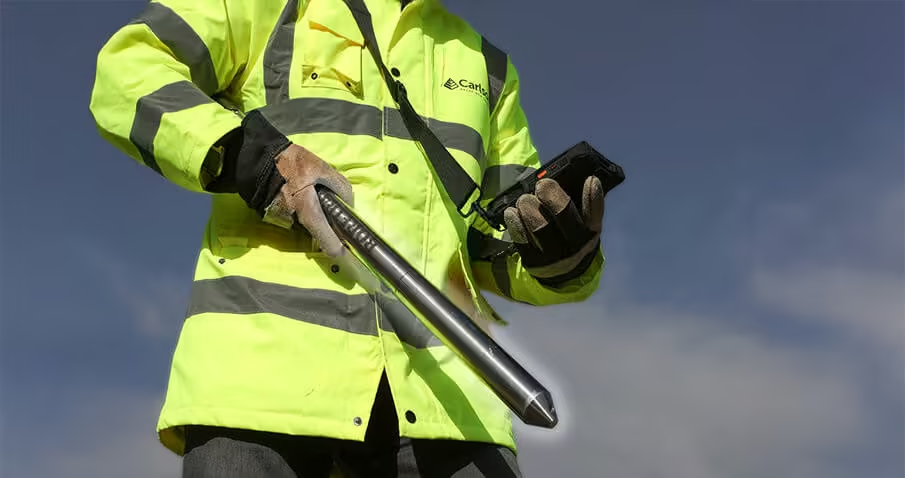
Precision Systems for High-Performance Mapping and Surveying
World-class systems and sensors for high-performance mapping, surveying, positioning and measuring, even in extreme environments.
Carlson’s high-speed measurement and surveying systems are designed for use in conditions where speed, accuracy and safety matter.
Their systems for mine and quarry scanning and vessel-mounted waterway scanning have been developed over many years of close work with those in the field, and have been adopted widely due to their reliability and ease of use.
Carlson’s high-speed measurement and surveying systems are designed for use in conditions where speed, accuracy and safety matter.
Their systems for mine and quarry scanning and vessel-mounted waterway scanning have been developed over many years of close work with those in the field, and have been adopted widely due to their reliability and ease of use.

Seeing Beyond the Surface with
Cutting-Edge GPR Technology
US Radar is a leading innovator of ground penetrating radar (GPR), systems. If you need to see what is on the other side of a surface, the high-profile Triple Frequency GPRover Mapping System can safely help you define what you can’t see with the bare eye.
GPR technology was first developed by ERA Technology of Leatherhead, Surrey, England, in the 1980s to locate plastic landmines as part of a British Ministry of Defense contract.
It helped reduce the risk of locating these dangerous, time-delayed bombs through rubble and in the ground. After performing admirably, commercial versions of the technology were developed in 1990, incorporating improvements that made it more user-friendly to the private sector and accessible to the masses.
GPR technology was first developed by ERA Technology of Leatherhead, Surrey, England, in the 1980s to locate plastic landmines as part of a British Ministry of Defense contract.
It helped reduce the risk of locating these dangerous, time-delayed bombs through rubble and in the ground. After performing admirably, commercial versions of the technology were developed in 1990, incorporating improvements that made it more user-friendly to the private sector and accessible to the masses.

Pioneering Safety and Innovation in Mining Technology
Reutech Mining is a passionate company dedicated to developing and manufacturing innovative technologies for the management of safety within the mining industry. They have been at the forefront of technological innovation for mining safety for more than a decade.
The company was established in 2006 after being approached by leaders in the mining industry to develop advanced geotechnical monitoring solutions. Since then the company has focused on providing and improving real-time mine safety for surface- and underground applications, as well as contributing towards notable increases in the production output of many mines globally.
The company’s mission is to understand the mining environment and to provide the industry with world class products.
The company was established in 2006 after being approached by leaders in the mining industry to develop advanced geotechnical monitoring solutions. Since then the company has focused on providing and improving real-time mine safety for surface- and underground applications, as well as contributing towards notable increases in the production output of many mines globally.
The company’s mission is to understand the mining environment and to provide the industry with world class products.
Transforming Survey Operations with Autonomous Marine Solutions
Seafloor Systems, Inc., founded in 1999 by Navy Veteran John Tamplin, is a pioneer in hydro-acoustic sonar and unmanned marine surface vehicle technology for the survey industry.
Seafloor developed the Hydrolite-TM echosounder in 2005 to integrate with standard GNSS survey kits, making hydrographic surveys accessible to land surveyors.
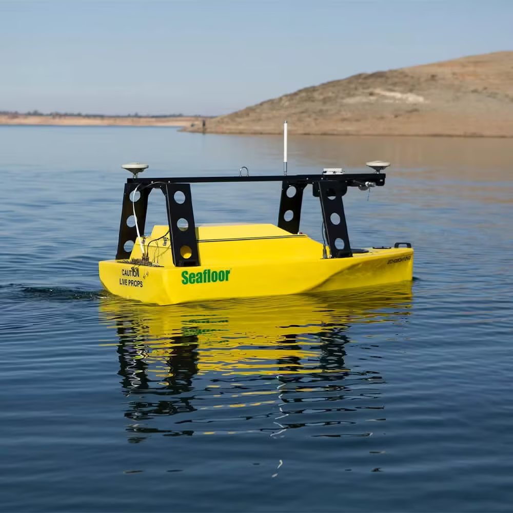
In 2010, the company introduced the HyDrone, a remotely controlled USV for deploying survey equipment in hazardous or hard-to-reach areas. This was followed in 2014 by the EchoBoat, a 1.8m mono-hull USV capable of deploying multibeam echosounders and other sensors, with full remote monitoring and control.
Seafloor’s AutoNav autopilot, introduced in 2015, allows users to pre-plan survey missions and let vehicles operate autonomously, returning automatically upon completion. In 2017, the first hot-swappable transducer well for EchoBoat made it possible to quickly switch sonar modules—including multibeam, sidescan, single beam, ADCP, and sub-bottom profilers—without removing the vehicle from the water.
With rugged, portable solutions and award-winning customer support, Seafloor remains a trusted leader in hydrographic survey technology.
Seafloor developed the Hydrolite-TM echosounder in 2005 to integrate with standard GNSS survey kits, making hydrographic surveys accessible to land surveyors.
In 2010, the company introduced the HyDrone, a remotely controlled USV for deploying survey equipment in hazardous or hard-to-reach areas. This was followed in 2014 by the EchoBoat, a 1.8m mono-hull USV capable of deploying multibeam echosounders and other sensors, with full remote monitoring and control.
Seafloor’s AutoNav autopilot, introduced in 2015, allows users to pre-plan survey missions and let vehicles operate autonomously, returning automatically upon completion. In 2017, the first hot-swappable transducer well for EchoBoat made it possible to quickly switch sonar modules—including multibeam, sidescan, single beam, ADCP, and sub-bottom profilers—without removing the vehicle from the water.
With rugged, portable solutions and award-winning customer support, Seafloor remains a trusted leader in hydrographic survey technology.

Flexible, High-Performance Drones for Smarter Decision-Making
Whether for geospatial, precision agriculture, open-cast mining or the construction industry – Quantum-Systems’ long-range, automatic transition aircraft capture and deliver data from above for enhanced and sustainable decision making.
To fulfil their mission, Quantum-Systems puts great importance on the perfect interaction between hardware and software.
Quantum-Systems drones are generally software and supplier independent. This way customers have the flexibility to choose the software they prefer and configure a solution that fits their individual needs for enhanced decision-making.
All Quantum-Systems components are developed 100% in-house in Germany. This includes the hardware, autopilot, as well as QBase 3D Mission Planning and Control Software. QBase 3D is perfectly tailored to their UAVs, making daily operation for the user as easy and intuitive as possible.
To fulfil their mission, Quantum-Systems puts great importance on the perfect interaction between hardware and software.
Quantum-Systems drones are generally software and supplier independent. This way customers have the flexibility to choose the software they prefer and configure a solution that fits their individual needs for enhanced decision-making.
All Quantum-Systems components are developed 100% in-house in Germany. This includes the hardware, autopilot, as well as QBase 3D Mission Planning and Control Software. QBase 3D is perfectly tailored to their UAVs, making daily operation for the user as easy and intuitive as possible.

Autonomous Aerial Robots for Complex, GPS-Denied Environments
Exyn Technologies was founded in 2014 by Nader Elm and Dr. Vijay Kumar as a spin out of The University of Pennsylvania’s General Robotics, Automation, Sensing & Perception (GRASP) Lab.
Exyn Technologies is pioneering autonomous aerial robot systems for complex, GPS-denied environments.
The company’s full-stack solution enables flexible deployment of single or multi-robots that can intelligently navigate and dynamically adapt to complex environments in real-time.
In 2020 the company unveiled he ExynAero for the mining industry.
Exyn Technologies is pioneering autonomous aerial robot systems for complex, GPS-denied environments.
The company’s full-stack solution enables flexible deployment of single or multi-robots that can intelligently navigate and dynamically adapt to complex environments in real-time.
In 2020 the company unveiled he ExynAero for the mining industry.

Integrated UAV Solutions for
High-Accuracy 3D Mapping
GeoCue is one of the largest supplier of kinematic LIDAR processing tools in North America.
In 2014, GeoCue Group started a division focused on using small Unmanned Aerial Systems for high accuracy mapping.
Leveraging their expertise in production, risk reduction, and point cloud processing tools, they are continuing to bring new products to market to provide geospatial professionals exciting tools for geospatial data extraction.
GeoCue has developed a family of 3D imaging sensors partnered with processing software and post deployment support to offer users a fully integrated solution for drone mapping applications.
In 2014, GeoCue Group started a division focused on using small Unmanned Aerial Systems for high accuracy mapping.
Leveraging their expertise in production, risk reduction, and point cloud processing tools, they are continuing to bring new products to market to provide geospatial professionals exciting tools for geospatial data extraction.
GeoCue has developed a family of 3D imaging sensors partnered with processing software and post deployment support to offer users a fully integrated solution for drone mapping applications.

Global Leader in IoT Connectivity for Remote Monitoring
Worldsensing is a global pioneer in IoT connectivity, helping organizations monitor critical infrastructure and remote assets through reliable wireless technology.
Founded in 2008 and headquartered in Barcelona, the company provides end-to-end solutions that connect sensors, networks, and software to deliver real-time operational intelligence.
Its technology is used across industries such as mining, construction, transport, and civil infrastructure, enabling safer operations, improved efficiency, and data-driven decision-making in projects around the world.
Founded in 2008 and headquartered in Barcelona, the company provides end-to-end solutions that connect sensors, networks, and software to deliver real-time operational intelligence.
Its technology is used across industries such as mining, construction, transport, and civil infrastructure, enabling safer operations, improved efficiency, and data-driven decision-making in projects around the world.

Rugged Mobile Computers Built to Withstand Any Environment
Handheld is a privately-held manufacturer of rugged mobile computers, including rugged tablets and PDAs.
Handheld is one of the fastest growing companies in the sector.
Together with our resellers around the globe, we form partnerships that offer products that withstand the toughest conditions and solutions to get the job done.
Handheld is one of the fastest growing companies in the sector.
Together with our resellers around the globe, we form partnerships that offer products that withstand the toughest conditions and solutions to get the job done.
Let’s Build the Future Together
Ready to take your projects to the next level? Our team is here to help you find the right geospatial solutions for your business.