Answers to Your Most Common Questions
Find quick, clear information on our products, services and support. Explore the questions we’re asked most often and get the guidance you need to keep your work moving.
Your Questions About OPTRON, Answered
Explore answers to common questions about OPTRON, products, services and support. Get the insights you need to make the most of our solutions.
OPTRON (Pty) Ltd is a subsidiary of the OPTRON Group (Pty) Ltd, a leading technology distribution and integration business focused on connecting the physical and digital worlds across Africa, through location – based hardware and software solutions.
OPTRON was established in 1986 by founder Pierre du Toit and has grown into a trusted provider of Geospatial technology solutions across the Africa continent.
OPTRON (Pty) Ltd is a South African based company, with head office in Centurion (Gauteng) and branch offices in Cape Town, Durban, Somerset West and Nairobi (Kenya). We also support clients through an extensive reseller network across sub-Saharan Africa.
OPTRON’s comprehensive range of products and services supports a diverse set of industries, including: Geospatial (Surveying and GIS), Mining, Civil Engineering and Construction, Building Construction, Energy and Water Utilities, Rail, Safety and Security, Unmanned Aerial Vehicles (UAVs), Field Services, Forestry, Agriculture, Transportation, Education, Government, and Land Administration.
OPTRON is an authorised distributor of leading global Geospatial technology brands across sub-Saharan Africa, including Trimble, DJI Enterprise, Spectra Geospatial, Nikon, Carlson Software, Reutech Mining, US Radar, Seafloor Systems, GeoCue, Exyn Technologies, EagleNXT, Quantum-Systems, and TRE Altamira. Our offering includes hardware, software, integration, training, technical support, and after-sales service – delivering end-to-end solutions tailored to client needs.
With over 40 years’ experience, OPTRON is one of Africa’s most established and trusted Geospatial technology providers and has been a Trimble partner since 1987 – the first outside North America.
Our continued success is driven by:
-
A skilled team of over 100 professionals, committed to excellence and innovation
-
A diversified strategy across Industries and Geographic regions
-
A dedicated Technical Support team of OEM-trained, certified specialists
-
An OEM-certified Service Centre for service, repairs, maintenance and calibration
-
ISO 9001:2015 Certification – ensuring consistent quality and service standards
Answers to Your Product Questions
Find clear, concise answers to common questions about our products. Learn how to get the most from Optron’s solutions and ensure optimal performance in every application.
Trimble FAQs
-
GNSS (Global Navigation Satellite Systems)
-
Total Stations
-
Laser Scanners
-
Mobile Mapping Systems
-
Machine Control Systems
-
Reality Capture Solutions
-
GNSS receivers and surveying equipment
-
Robotic and mechanical total stations
-
Laser scanning and reality capture systems
-
Field data collection systems
-
Survey software
-
Workflow consultation and optimisation
-
Field-to-finish system integration and configuration
-
Equipment setup and troubleshooting
-
Application specific technical training
-
Technical support
-
Software updates
-
Equipment servicing, repairs, calibration and maintenance
-
Firmware updates and diagnostics
-
Hardware & software subscriptions
-
Surveying and Geospatial
-
Agriculture
-
Construction
-
Transportation and Logistics
-
Civil Engineering
-
Utilities and Infrastructure
-
Architecture and Structural Engineering
-
Mining


DJI FAQs
-
Surveying and geospatial mapping
-
Utilities and energy
-
Construction and earthworks monitoring
-
Public safety and emergency response
-
Mining and quarry operations
-
Environmental monitoring
-
Infrastructure inspection
Training typically covers:
-
Drone operation and flight planning
-
Best practices for accuracy and safety
-
Data capture
-
Software workflows and data processing
-
Assistance with drone setup and configuration
-
Troubleshooting and operational guidance
-
Firmware and software updates
-
Workflow support for data processing and integration
Services may include diagnostics, repairs, firmware updates and general maintenance.
Spectra Geospatial FAQs
Owned by Trimble, Spectra Geospatial focuses on delivering reliable, cost-effective solutions.
-
Workflow consultation and optimisation
-
Technical support
-
Field-to-finish system integration and configuration
-
Software updates
-
Equipment setup and troubleshooting
-
Equipment servicing, repairs, calibration and maintenance
-
Application specific technical training
-
Firmware updates and diagnostics


Nikon FAQs
-
Reliable performance in demanding environments
-
Excellent optical quality
-
User-friendly operation
-
Cost-effective surveying solutions
-
Durable design for field conditions
Training can include:
-
Instrument setup and operation
-
Survey workflows and field techniques
-
Best practices for accurate measurements
Carlson FAQs
-
One-button measurement
-
Simple menu navigation
-
Built-in display
-
Automatic calculations
-
Workflow consultation and optimisation
-
Equipment setup and troubleshooting
-
Field-to-finish system integration and configuration
-
Application specific technical training
-
Technical support
-
Equipment servicing, repairs, calibration and maintenance
-
Firmware updates and diagnostics


EagleNXT FAQs
-
Drone operation and flight planning
-
Data capture
-
Best practices for accuracy and safety
-
Software workflows and data processing
-
Assistance with drone setup and configuration
-
Firmware and software updates
-
Troubleshooting and operational guidance
-
Workflow support for data processing and integration
Reutech Mining FAQs
-
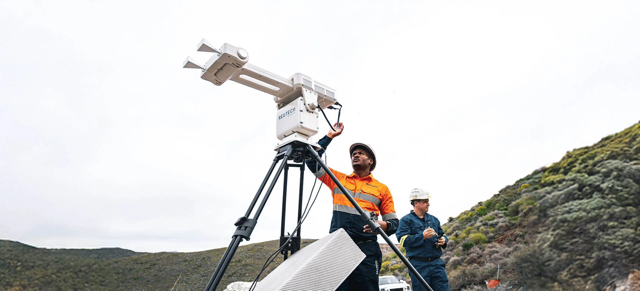
MSR Modular – A flexible radar system for monitoring slope movement in open-pit mines.
-
MSR IV Esprit – High-speed radar designed to detect rapid ground movement and potential slope failures.
-
MSR Halo – A 360° Synthetic Aperture Radar system for long-range slope monitoring.
-
Multi‑Purpose Platform – A modular platform for deploying monitoring equipment, cameras, and sensors.
-
Slope Vision System – A camera system that provides visual monitoring of mine slopes.
-
MSR Connect – Monitoring software for real-time radar data visualisation and alerts.
-
Sub‑Surface Profiler – A handheld ground-penetrating radar device used underground to detect rock structures and fall-of-ground risks.

US Radar FAQs
The systems are mainly used to detect and map buried utilities, voids, pipes and other underground features without the need for excavation.
-
Construction and civil engineering
-
Utility locating
-
Transportation infrastructure
-
Environmental assessment
-
Geotechnical investigations
-
Handheld GPR systems
-
Cart-based scanning systems
-
High-resolution subsurface imaging solutions
-
Data analysis and visualization software
-
Reduced risk of striking underground utilities
-
Non-destructive subsurface investigation
-
Improved project safety and efficiency
-
Faster site decision-making
Seafloor Systems FAQs
-
Hydrographic surveying
-
Civil engineering and construction
-
Environmental monitoring
-
Disaster response and flood mapping
-
Dredging and waterway management
-
Single-beam and multibeam echo sounders
-
GPS/GNSS positioning systems
-
Side-scan sonar
-
Water quality and environmental sensors


GeoCue FAQs
-
Topographic surveying
-
Urban modelling
-
Corridor and infrastructure mapping
-
Environmental monitoring
-
Mining and stockpile volumes
-
Point cloud processing
-
Surface modelling
-
Data classification
-
Deliverable generation
-
System selection and configuration guidance
-
Training for operators and analysts
-
Installation and workflow integration
-
Technical support and after-sales service
Exyn FAQs
-
Underground mines
-
Warehouses
-
Industrial facilities
-
Tunnels and confined spaces
-
Mining and stockpile volumes
-
System selection and configuration guidance
-
Training for operators and analysts
-
Installation and workflow integration
-
Technical support and after-sales service


Quantum-Systems FAQs
-
Large-area mapping and surveying
-
Mining and resource monitoring
-
Infrastructure and corridor mapping
-
Agriculture and environmental monitoring
-
Security and situational awareness
-
Take-off and landing in small areas
-
Long flight endurance
-
Efficient coverage of large survey areas
-
High-quality aerial data capture
-
RGB mapping cameras
-
Multispectral sensors
-
Other specialised aerial imaging systems
-
System selection and configuration guidance
-
Training for operators and analysts
-
Installation and workflow integration
-
Technical support and after-sales service
TRE ALTAMiRA FAQs
-
Wide-area coverage
-
Cost-effective monitoring over time
-
Historical deformation analysis
-
Early warning of ground stability issues


XGRIDS FAQs
software solutions that convert real-world environments into detailed digital models for analysis, visualisation,
and digital twin applications.
3D Gaussian Splatting (3DGS) to capture, process, and render highly realistic 3D spatial data.
surveying, engineering, public safety and gaming.
visualisations from captured spatial data, enabling photorealistic digital environments.
allowing XGRIDS systems to build accurate 3D representations of buildings, landscapes, and infrastructure.
-
System selection and configuration guidance
-
Installation and workflow integration
-
Training for operators and analysts
-
Technical support and after-sales service
Worldsensing FAQs
performance of infrastructure and geotechnical environments.
ground movement, structural stability, and environmental conditions in real time.
monitoring projects.
piezometers, extensometers, tiltmeters and vibration sensors.
visualise, analyse and receive alerts about changes in monitored conditions.
-
System selection and configuration guidance
-
Installation and workflow integration
-
Training for operators and analysts
-
Technical support and after-sales service

Still Have Questions?
If you didn’t find the answers you were looking for in our FAQs, our team is here to help. Reach out today for expert guidance and support tailored to your needs.