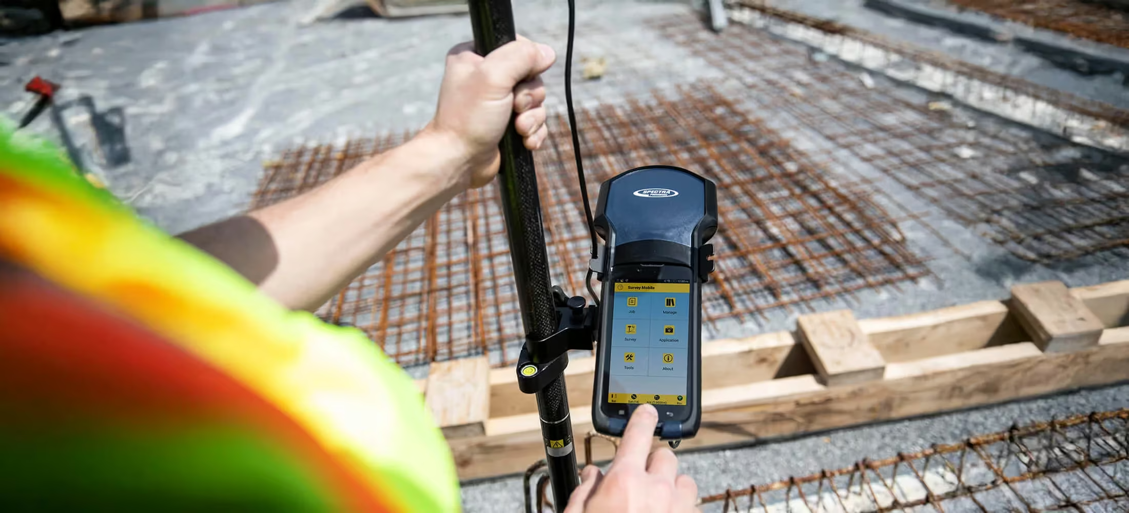
Survey Mobile
Get your work done fast and efficiently
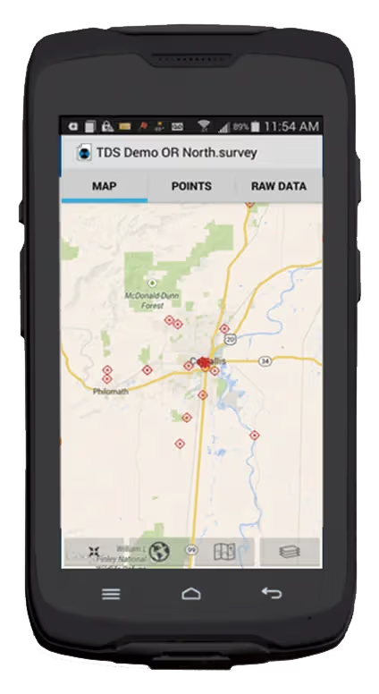
Spectra Precision Survey Mobile (SPSM) is an easy to learn and simple to use field software for surveyors who want to get their work done fast and efficiently. The user interface is designed to be simple and straightforward so surveyors can be productive immediately.
Need a Quote?
We’ll Call You
Simply enter your contact details and one of our specialists will call you to discuss your requirements and provide a detailed quotation.
Need a Quote?
We’ll Call You
Simply enter your contact details and one of our specialists will call you to discuss your requirements and provide a detailed quotation.

Connected Tools for Seamless Data Access and Control
Central brings together web, mobile, desktop, and field software into a single connected ecosystem. With browser-based access, dedicated mobile apps, automated data synchronisation, and deep Survey Pro integration, teams can manage, back up, and share project data effortlessly. This unified approach helps keep information up to date across devices, reduces manual file handling, and ensures critical data is always protected and accessible wherever work takes place.
Web Portal
The web portal at spectrageospatial provides easy way to edit, manage, and use your Central accounts and data. It can be accessed with any browser from your office computer, tablet, or smart phone.
Smart Phone Apps
Survey Pro Central for Android and Survey Pro Central for iOS provide access with dedicated smartphone and tablet apps. These apps provide data access and a range of functionality to help you manage your data, and therefore your workday, better.
Spectra Precision Central Sync
Central Sync is a tool that runs as a service on your computer and synchronizes data that is placed in the central folders. This makes file data management and synchronizing data with Central very easy.
Survey Pro Integration
Survey Pro is fully integrated into Spectra Precision Central. Files are uploaded as they are created. New data is sent up to Central based on user preferences. So now, not only do Spectra Precision ultra-rugged data collectors and dedicated field software protect your data, so does Central, backing it up on a remote server.
Seamless Data Sharing and Broad Hardware Support
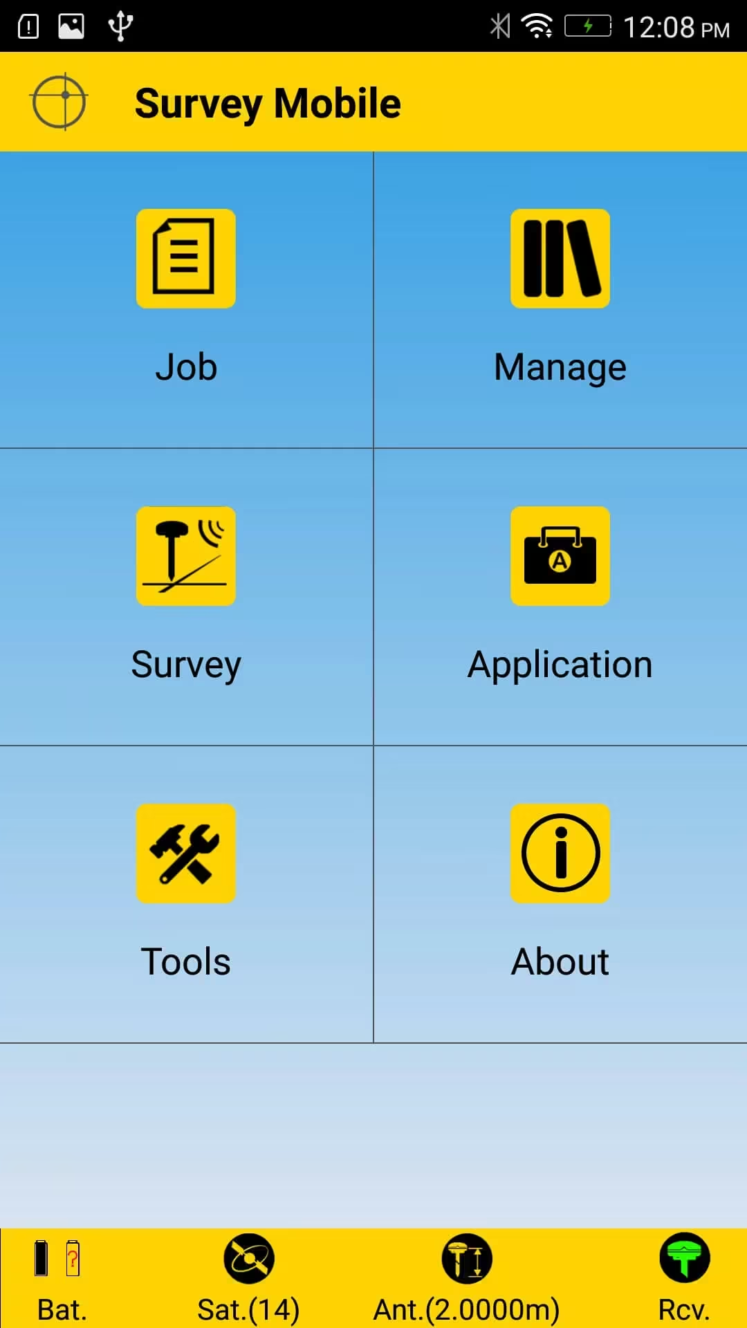
Sharing data between crews is seamless with importing and exporting capabilities. Surveyors can measure, stakeout and calibrate a site in their coordinate system of choice after configuring their receiver settings.
SPSM currently supports the Spectra Precision SP60,SP80 GNSS receivers and Mechanical Total Stations Nikon such as NPL-322/322+, DTM-322/322, Nivo M series, Focus 8 & Focus 6.
The software is optimized for use on Android devices v4.3 and higher. SPSM allows users the flexibility to use any Android supported device.
The features and functionalities provided by Spectra Precision Survey Mobile will enable surveyors to be productive and efficient in the field where every second counts.
Need a Quote?
We’ll Call You
Simply enter your contact details and one of our specialists will call you to discuss your requirements and provide a detailed quotation.
Versatile Features for Efficient Fieldwork
Designed to support a wide range of surveying tasks, these total stations combine accuracy, speed, and modern connectivity. Flexible measurement options, fast distance capture, and seamless data transfer help streamline workflows, while smart pairing and portable charging solutions keep you productive wherever the job takes you.
Need a Quote?
We’ll Call You
Simply enter your contact details and one of our specialists will call you to discuss your requirements and provide a detailed quotation.
Key Features
-
Easy to learn
-
Simple to use
-
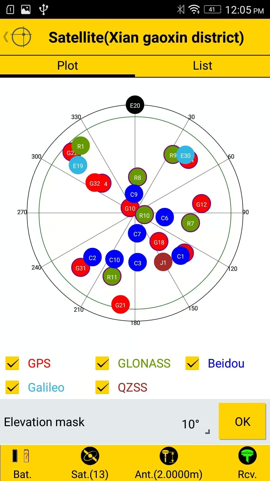
Common GNSS survey support
-
Fast setup and survey
-
Supports Android v4.3 & higher
-
Long Range Bluetooth
-
RTX Configuration
-
Mechanical Total Station Support
Key Features
-
Easy to learn
-
Simple to use
-
Common GNSS survey support
-
Fast setup and survey
-
Supports Android v4.3 & higher
-
Long Range Bluetooth
-
RTX Configuration
-
Mechanical Total Station Support
General Survey
Topological point survey, multi-epoch control point survey, offset distance point survey, and fast survey with controller internal GNSS.
Static Survey
Static survey and data logging.
Stop & Go Survey
To log number of points in the same job.
Roading
Road elements supported including importing road design files, defining road elements, defining intersections and stakeout of rad stations.
Site Calibration
Grid to local transformation.
Define
Topological point, control point with grid coordinates or WGS84 geodetic coordinates.
Stake-out
-
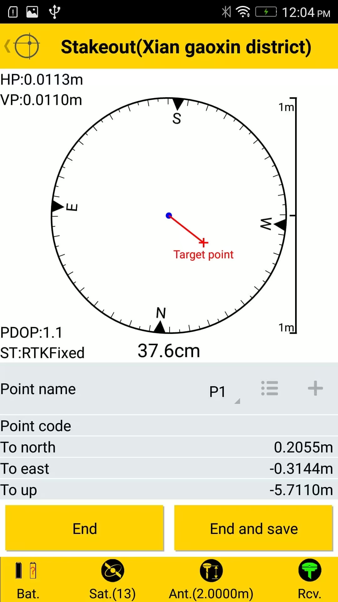
Point and line stakeout.
-
Offset Survey
COGO
Calculate points based on distances and angles.
Import & Export
Import: Point (txt,csv), AutoCad (dxf), Coordinate System (scs), Job (jxl), Roads (rxl).
Export:Point (txt,csv), South CASS (dat), AutoCad (dxf), Job (jxl), Roads (rxl), Coordinate System (scs), Static Survey Report (txt).
Receiver Config
RTK Radio (Internal, External), RTK Network (VRS), RTK Bluetooth (Long Range SP60 only) & RTX
See Survey Basic in Action
Explore Survey Mobile through real-world visuals that highlight its intuitive workflows, device flexibility, and performance in active field environments.


Need a Quote?
We’ll Call You
Simply enter your contact details and one of our specialists will call you to discuss your requirements and provide a detailed quotation.
-
SP Central
Spectra Central Precision® provides a cloud computing hub for your full survey team to connect and exchange information from anywhere there is a data connection. -

Survey Office
Survey Office v5.30 is the all-in-one software for surveyors, ideal for processing GPS, GNSS, and optical survey data, with innovative features and an easy-to-use interface. -

Survey Basic
Survey Basic™ on-board software provides you with the simplicity and familiarity of the tradition Nikon button-based user interface, together with the benefits of a colour touch screen. -

Layout Pro
Layout Pro Field and Layout Pro Office construction positioning solutions give contractors more control of their job sites allowing significant improvements in construction accuracy and productivity. -

Survey Pro
Spectra Precision® Survey Pro field software provides you with a complete set of capabilities for all your survey projects. It’s fast, reliable and easy to use.