
Exploring How Surveying Drones, 3D Scanners and AI Are Changing the Industry
Contact OPTRON to find out more about our Survey Drone solutions!
When paired with 3D scanning and AI, surveying drones are fundamentally reshaping spatial data capture. Their adoption across industries is streamlining workflows, eliminating previous barriers of time and terrain. By forming a connected ecosystem, these technologies convert complex site information into actionable, decision-enabling insight. This technological convergence defines the future of digital surveying: rapid, intelligent and precise. Surveyors can now make informed decisions in minutes rather than hours, boosting responsiveness and project management for teams across Africa and beyond.
Emerging Trends: Surveying Drones, Automation and Cloud-Powered Workflows
Surveying is shifting from manual methods to integrated digital ecosystems, where drones, scanners and AI interconnect to create data-rich environments. These technologies enable continuous mapping and automated updates, transforming static data into dynamic assets as projects progress. Let’s explore the top three emerging trends shaping this digital transformation:
1. Surveying Drones on the Rise
Surveying drones are transforming how professionals collect and interpret spatial information. No longer limited to aerial photography, modern platforms now incorporate precision sensors, LiDAR and photogrammetry tools that deliver measurable outputs across industries.
Our range of DJI professional surveying drone platforms addresses the growing demands of modern surveying. These systems combine robust flight control, intelligent imaging and onboard processing, making them suitable for applications such as terrain mapping, infrastructure inspection and agricultural monitoring.

OPTRON is also one of the only DJI Authorised and Certified Service Centres in Sub-Saharan Africa, offering professional maintenance, calibration and repair services to ensure optimal equipment performance and minimal downtime.
With these advanced platforms, survey teams capture accurate geospatial data quickly and safely, even in complex or hazardous environments. The broader area coverage and higher reliability result in faster turnaround, lower field costs and stronger decisions from the first dataset.
As aerial intelligence continues to advance, pairing it with ground-based precision unlocks new possibilities – this is where 3D scanning comes in.
Many professionals opt for robotic total stations, which allow a single operator to control the instrument remotely – boosting productivity even further.
2. 3D Scanning Goes Mainstream
With more efficient aerial capture, ground-level accuracy is equally vital. Once specialised, 3D scanning is now integral to surveying and engineering, precisely mapping structures, terrain and built environments.
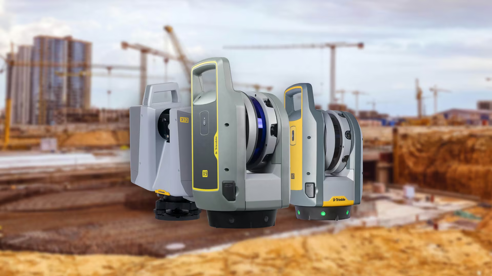
Our Trimble 3D laser scanning systems provide the speed and accuracy survey teams need to capture dense point clouds quickly. These datasets allow detailed as-built documentation, volume calculations and infrastructure analysis with confidence.
3D scanning records every visible surface. It gives surveyors a digital record they can use at any time. When used with drones, this method combines aerial views with ground detail. The result is a detailed, unified model that supports good planning and work.
3. AI and Cloud Platforms Transform Digital Surveying Workflows
Artificial intelligence is becoming the engine behind digital surveying. Beyond automating flight paths or scan alignment, AI supports how spatial data is processed, classified and interpreted.
Drones and scanners equipped with intelligent algorithms can recognise terrain features, detect structural changes and generate accurate models faster than before.
When linked with cloud platforms, such as the Trimble R980 Integrated GNSS System,
these technologies create a connected ecosystem where teams store, process and collaborate on data in real time. Large datasets from sky and ground sources are automatically merged, cleaned and structured, enabling decision-makers to visualise progress, monitor accuracy and share updates instantly.
For surveyors across Africa, this advancement means quicker delivery, fewer manual tasks and stronger data integrity. Projects no longer rely on fragmented workflows – AI and cloud integration ensure that every stage, from capture to insight, operates as a single intelligent process.
Together, these innovations are not only transforming how data is collected and analysed but also redefining the measurable benefits that follow.
Though these scanners represent a higher upfront investment, the value they provide for large-scale or intricate projects makes them a powerful tool in any surveyor’s workflow.
The Benefits of Combining Surveying Drones, 3D Scanners and AI
Uniting surveying drones, 3D scanners and AI delivers a powerful data-driven approach. This integration transforms accuracy, speed and collaboration, empowering surveyors to generate deeper insights and higher-value outcomes with less time in the field.
Faster, More Efficient Workflows
With drones, scanners and AI working together, projects move faster. Drones map large areas quickly, laser scanners gather detailed data with minimal effort and AI speeds up the processing, making every project stage more efficient.
Enhanced Accuracy and Consistency
Merging aerial imagery and terrestrial point clouds removes measurement gaps and improves precision. AI-driven calibration ensures consistency, delivering the repeatable outcomes needed for engineering-grade accuracy.
Safer, More Sustainable Operations
Surveying drones and 3D scanners reduce the need for physical presence in risky or remote areas. Whether mapping mines, bridges or industrial sites, they capture high-quality data remotely, improving safety and reducing environmental impact.
Predictive and Preventive Insights
AI makes surveying more preventive. It uses models to spot early signs of movement, wear or terrain change. Teams can fix issues before they grow. This helps with maintenance, keeps costs low and manages assets for the long term.
With access to local expertise, training and technical support, we empower organisations to adopt future-ready workflows that bring innovation to African projects.
What Sets OPTRON Apart
At OPTRON, we bring deep geospatial expertise to the intersection of technology and fieldwork. As regional distributors for DJI and Trimble GNSS solutions, we equip clients with advanced tools, local insight and dedicated support.

We don’t just supply equipment; we transform workflows. By collaborating with clients, we design integrated solutions that enhance accuracy, efficiency and safety from field capture to final insight.
Every recommendation we make is driven by measurable value.
Through global partnerships and regional experience, we bridge innovation with real-world application. Our approach helps surveyors and engineers across Africa adopt digital surveying systems that meet international standards and perform in local conditions.
In sectors like mining, infrastructure and construction, we’re leading the shift to hybrid workflows that combine surveying drones and 3D scanning. By integrating DJI aerial platforms with Trimble 3D laser scanning and GNSS technology, we deliver connected systems that raise the bar on precision, productivity and safety.
With our ongoing training and technical support, we help clients implement future-ready surveying solutions built for Africa.
Looking Ahead: The Future of Surveying
The next era of digital surveying will be defined by automation, intelligence and integration. Surveying drones will become increasingly autonomous – planning missions, capturing data and performing quality checks with minimal human input. 3D scanners will continue to integrate seamlessly with aerial platforms to capture every facet of a project within a single, coordinated workflow.
Artificial intelligence will transform from a post-processing assistant into a real-time decision engine that detects changes, predicts outcomes and guides field operations instantly. Meanwhile, cloud collaboration ensures every stakeholder – from surveyor to project manager – works from the same live dataset, improving transparency and efficiency.
For Africa’s infrastructure, construction and mining sectors, this connected workflow redefines surveying. Teams will move from reactive measurement to predictive intelligence, achieving faster, safer and more sustainable outcomes. With OPTRON leading the way, the continent is ready for a smarter, data-driven future of surveying.
Experience the Future of Surveying with OPTRON
As surveying technology continues to advance, precision and efficiency are no longer optional – they’re essential. We equip professionals with integrated drone, scanning and AI systems that streamline data capture, analysis and collaboration across every stage of a project.
Our specialists support surveyors, engineers and contractors in adopting connected digital workflows that reduce downtime, enhance accuracy and drive operational excellence. With decades of regional experience and trusted global partnerships, OPTRON delivers innovative geospatial ecosystems tailored to Africa’s unique demands.
Partner with us to drive measurable progress that delivers consistent performance, reliability and confidence from field to finish.