InSAR Monitoring
Precise, Wide-Area Ground Movement Detection from Space
Unlike visible or infrared light, radar waves penetrate most weather clouds and are equally effective in darkness. Therefore, with InSAR it is possible to track ground deformation even in bad weather and at night.
Need a Quote?
We’ll Call You
Simply enter your contact details and one of our specialists will call you to discuss your requirements and provide a detailed quotation.
Need a Quote?
We’ll Call You
Simply enter your contact details and one of our specialists will call you to discuss your requirements and provide a detailed quotation.

InSAR monitoring provides regular updates of ground surface and single asset displacement.
InSAR Monitoring transforms satellite radar acquisitions into precise displacement measurements through advanced image processing and data analysis. The result is reliable ground surface motion maps and time-series insights for thousands of measurement points, delivered in near real-time. From wide-area regional assessments to detailed single-asset monitoring, organisations gain continuous visibility of surface dynamics, enabling early identification of movement hotspots and informed risk management decisions.

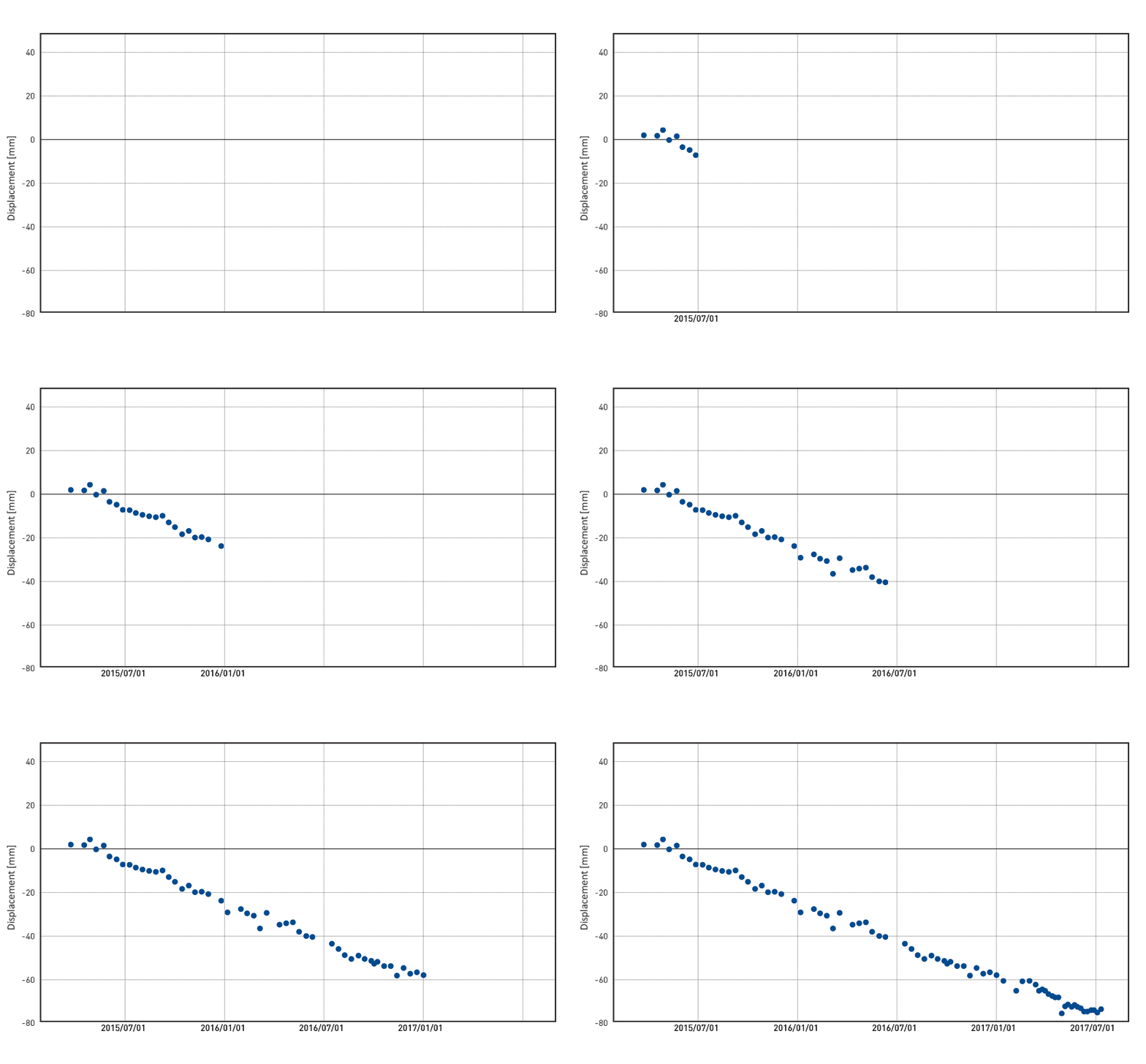
InSAR Monitoring
Providing ground surface motion maps and displacement time series of thousands of measurement points in near real-time.
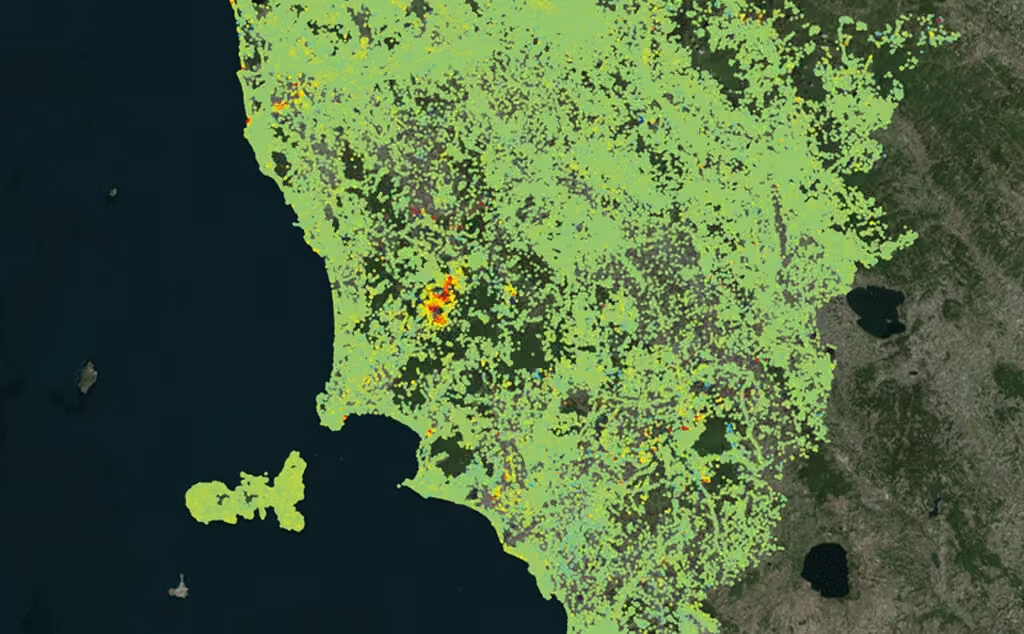
Wide Area
Regional to national scale displacement information is routinely provided to end-users and decision makers.
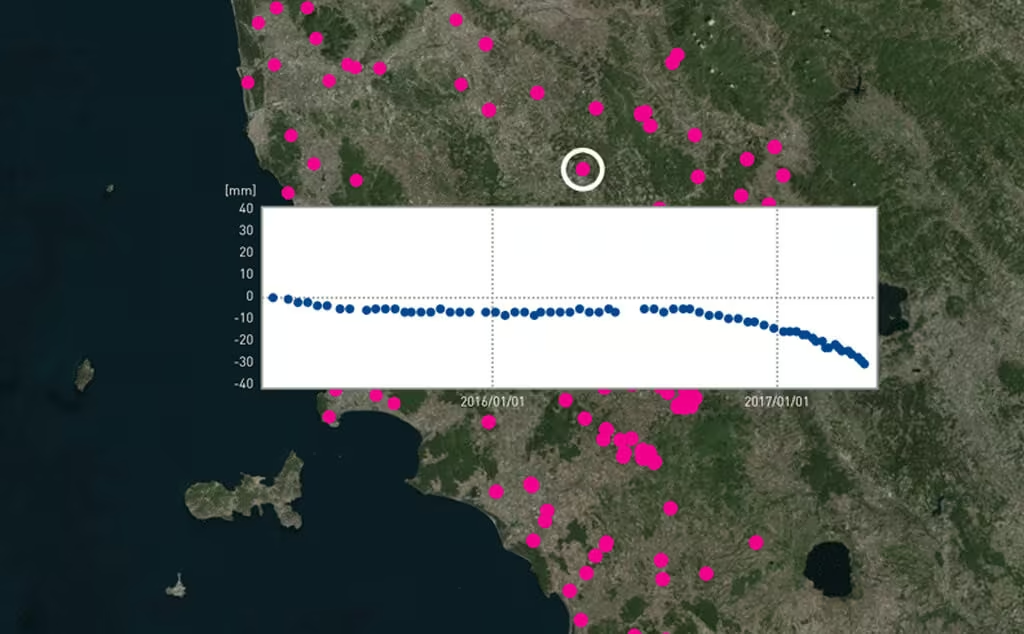
Continuous Monitoring
Get actionable information on risky areas through the identification of hotspots, showing a change in the dynamic of motion.
Comprehensive InSAR Monitoring for Mining Operations
Measure deformation from millimetres to metres over all mining surfaces, structures and assets without the installation of any in-situ equipment.
Need a Quote?
We’ll Call You
Simply enter your contact details and one of our specialists will call you to discuss your requirements and provide a detailed quotation.
Need a Quote?
We’ll Call You
Simply enter your contact details and one of our specialists will call you to discuss your requirements and provide a detailed quotation.
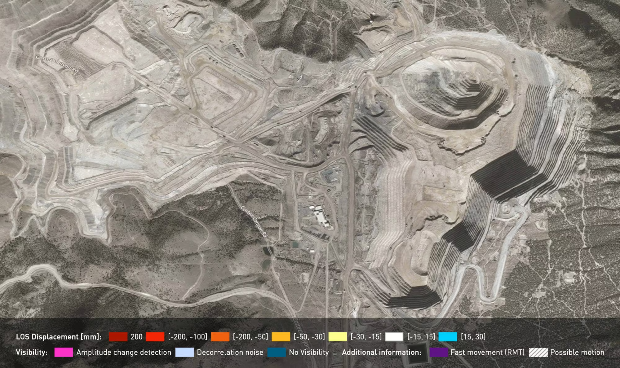
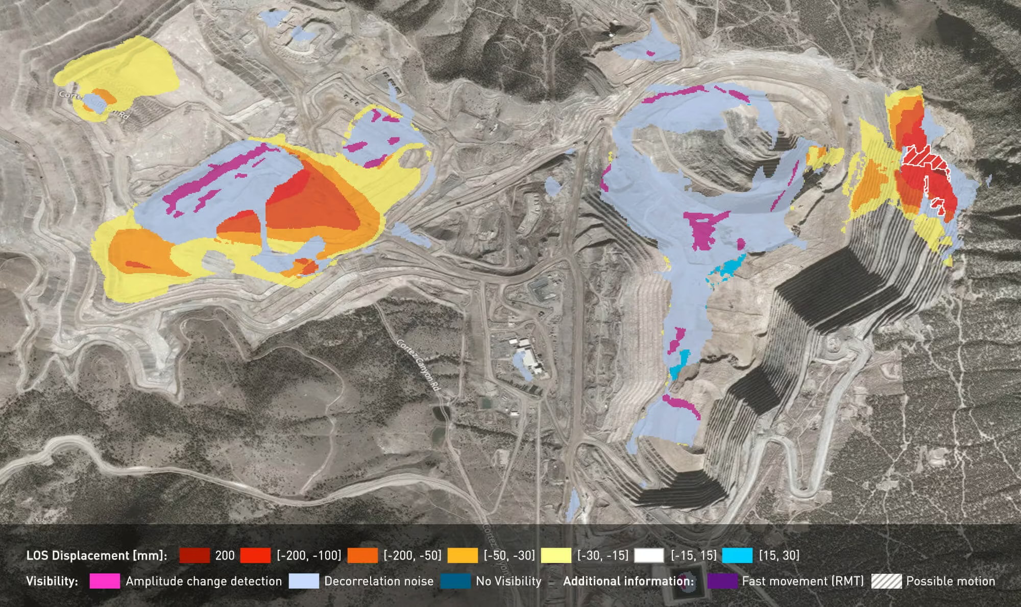
Ground motion monitoring with bulletin
Get actionable reports on trends and changes to the ground surface showing movement ranging from millimetres to metres.
Intuitive colour-coded deformation maps highlight areas where changes in trend are occurring with respect to previous situations, providing magnitude and areas of deformation at a glance over the entire mine site.
-
Benefit from a quick visualization of deformation trends
-
Seamlessly import our maps into your visualization software
-
Require tailored report schedules (from every few days to annual)
-
Access archives back to 1992 to enhance geotechnical back analysis
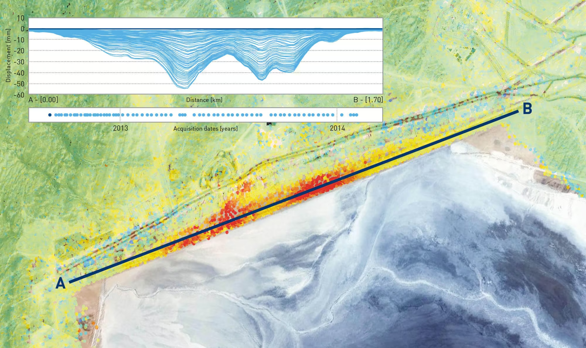
Tailings dam stability
Use InSAR to monitor the smallest to the largest dams without the need for on-site visits or installations.
Tailings dam failures are extremely detrimental to mine productivity.
Surface deformation and unattended fractures are common precursors for such costly and harmful events.
-
Request frequent updates on the consolidation level and eventual horizontal slips
-
Benefit from our remote measurements when access is limited for conventional surveying techniques
Solutions for pit monitoring
Our InSAR mapping service complements in-situ instrumentation, providing an overview of slope movements.
Open pit operations pose many challenges in terms of safety-critical monitoring.
-
Investigate slope movements on a weekly basis, utilizing InSAR’s mm-sensitivity, even when precursors are not visible to local alarming facilities
-
Easily integrate InSAR data with other geodetic measurements in major monitoring platforms
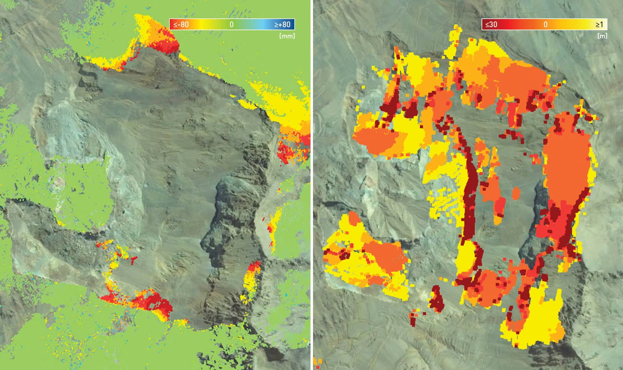
Underground – Block caving subsidence mapping
Frequent InSAR updates are delivered to surveyors for optimal integration and geotechnical teams for subsurface modelling.
Block caving operations pose serious challenges when dealing with surface displacement monitoring. As heavy subsidence is normal for deep operations, it is essantial to monitor its impact on existing infrastructures to assure service continuity.
-
Analyse complex subsidence patterns with InSAR (up to hundreds of measurement points per km2)
-
Rely on millimetre-precision vertical displacement measurements
See the S.O.D.A. 3D in Action
Watch how the S.O.D.A. 3D performs in real-world mapping scenarios, showcasing its ability to capture precise oblique imagery and deliver high-quality 3D reconstruction results in complex environments.
Related Images


Need a Quote?
We’ll Call You
Simply enter your contact details and one of our specialists will call you to discuss your requirements and provide a detailed quotation.