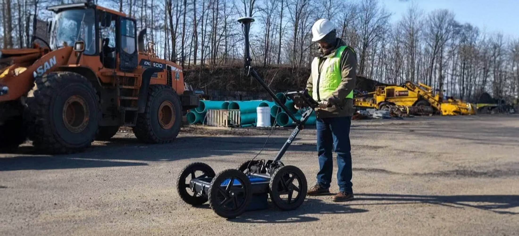
GPRover
Advanced, integrated sub-surface Imaging
The GPRover is not just a GPR, but a sophisticated platform that integrates advanced subsurface imaging technology, high accuracy GPS, and mapping capabilities into one system that marries global GPS connectivity with award winning triple bandwidth technology. With this unit the science of mapping utilities has become within reach of anyone with the knowledge to locate utilities and can provide accurate underground infrastructure imaging and mapping easily.
Need a Quote?
We’ll Call You
Simply enter your contact details and one of our specialists will call you to discuss your requirements and provide a detailed quotation.
Need a Quote?
We’ll Call You
Simply enter your contact details and one of our specialists will call you to discuss your requirements and provide a detailed quotation.

Precision Utility Mapping with Triple-Bandwidth Radar
GPRover harnesses ground penetrating radar technology for superior locating and data collection capabilities; integrating advanced subsurface imaging technology with high accuracy GPS and mapping.
The antenna’s award-winning triple bandwidth technology also provides a deeper, clearer read of what’s beneath the surface you’re scanning.
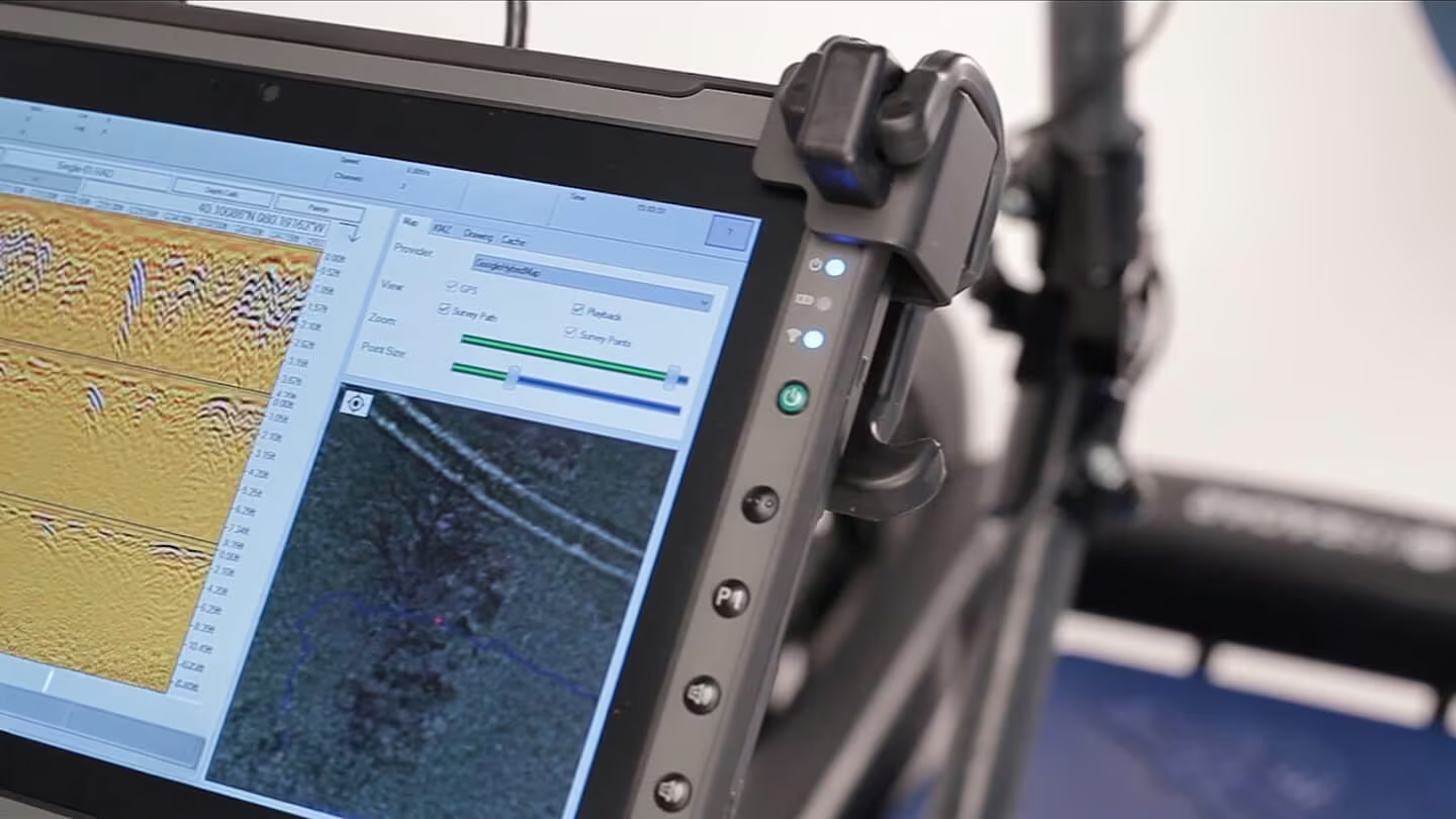
Our GPRover unit simplifies the science of utility mapping. Anyone with utility locating knowledge can quickly learn how to operate the GPRover and rely on it to provide accurate underground infrastructure imaging and mapping results. using our suite of radar software solutions, user-created datasets can be stored and shared right from the system’s Windows Getac tablet.
The GPRover Difference
-
Easy to learn and operate
-
Provides unrivaled accuracy within 5cm. (2in.)
-
Creates deliverable data that operate and field crew can use immediately

Unique GPRover Features
-
Annually renewable subscription connects you to multiple reliable networks, no matter your location
-
No cellular modem or base station required – connect the battery, power on, calibrate your antenna, and start scanning.
GPRover Applications
With greater depth penetration and resolution than any other locating technology, the system can detect anything from fiber optic cables to utilities up to 9.14m deep and everything in between. The three separate datasets generated simultaneously by the triple bandwidth antenna can then be analyzed and cross-compared to create accurate, actionable information for the crew on the job site.
Comprehensive Detection Across All Subsurface Conditions
With greater depth and resolution than any other locating technology, the GPRover can be used for anything from fiber optic analysis to utilities up to 9.14 m+ deep and everything in between.

Integrated Design for Accuracy, Efficiency, and Field-Ready Performance
It all comes together in a configuration that is easy to learn and implement, provides stunning high accuracy of 5cm and enables the operator to provide a deliverable that crew in the field can immediately use.
Need a Quote?
We’ll Call You
Simply enter your contact details and one of our specialists will call you to discuss your requirements and provide a detailed quotation.
Durable, Glare-resistant Tablet Interface
-
Daylight readable, weatherproof Getac tablet interface
-
High performance CPU enables real-time data processing
-
Built-in 3D view capability
-
WiFi supported
-
ESB, Ethernet, and Audio ports
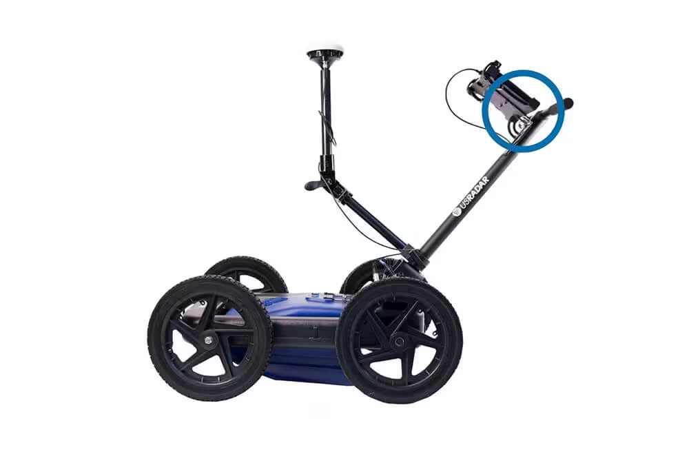
Stepped Pulse Triple Frequency Antenna
-
Triple frequency antenna means three scans in one
-
Sloped antenna design allows the system to glide smoothly over uneven terrain and surface obstacles, maintaining consistent ground contact and data accuracy without interrupting the scanning process.
-
Optional GPS integration
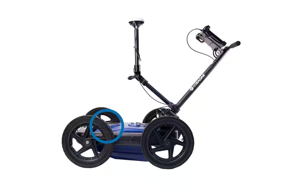
Hot Swappable Battery Packs
-
Two hot-swappable battery packs included in each system
-
Each battery lasts a total runtime of 8 hours each
-
Battery packs have lifespan of several years
Gps Integration (Optional)
-
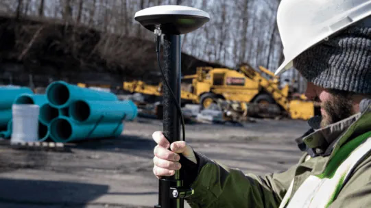
Optional GPS Pole mount
-
Enables GPS to be centered over antenna
-
Integrates with most high-end GIS and RTK units
-
Optional integration with Google Earth
Airless Tires
-
Airless, solid tires that cannot go flat
-
Require no maintenance
Easy Storage
-
Folding cart handle and controller tablet mount for easy storage.
Patented Tilt Correction Technology
The GPRover features patented slope correction technology that corrects GPS positions for slope and cross-slope of the GPR and GPS antennas to increase overall accuracy on uneven terrain.
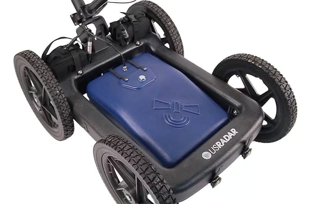
Why Triple Frequency?
The GPRover is built on the award winning Triple Bandwidth that we offered with our Quantum Imager.
Need a Quote?
We’ll Call You
Simply enter your contact details and one of our specialists will call you to discuss your requirements and provide a detailed quotation.
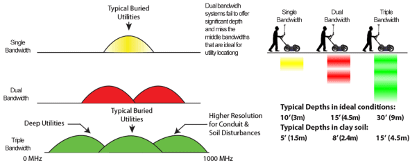
Triple bandwidth offers drastically more depth as well as higher resolution than any other imaging technology on the market. This is because of the lower bandwidth of dual bandwidth systems.
Dual bandwidth systems also miss the middle bandwidths ideal for utility locating.
See the GPRover in Action
Explore real-world footage and field imagery showcasing the GPRover’s performance in action. From live utility scans to on-site data visualization, see how the system delivers precise subsurface insights across diverse environments and job conditions.
Related Images


Need a Quote?
We’ll Call You
Simply enter your contact details and one of our specialists will call you to discuss your requirements and provide a detailed quotation.
-

Quantum Imager
The triple frequency Quantum Imager by US Radar is capable of significantly greater depths with higher resolution than any other locating technology. -

Q5C PLUS
Simply put, the Q5C Plus is a buried utility location workhorse. It is easy to use yet it can be expanded and configured for other applications and needs down the road. -
Q25
The Q25C is a 250MHz locating system for deep utilities and Geotechnical applications. -

Q10
The Q10C is a high resolution 1000 or 900 MHz GPR Cart System for Bridge Deck Scanning and other high resolution/shallow applications.