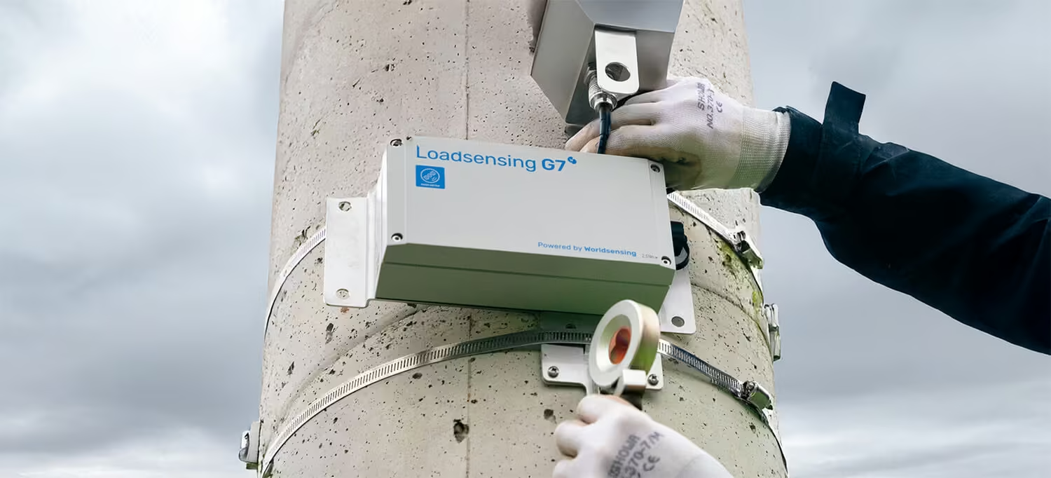
GNSS Tiltmeter
High-Precision GNSS Monitoring for Structural and Ground Movements
The GNSS Meter delivers accurate, real-time position data for monitoring slopes, infrastructure, and ground movements. Its wireless connectivity and long-range LoRa communication enable reliable remote deployment, while robust battery life and seamless integration with Worldsensing platforms ensure continuous, unattended monitoring in even the most challenging environments.
Need a Quote?
We’ll Call You
Simply enter your contact details and one of our specialists will call you to discuss your requirements and provide a detailed quotation.
Need a Quote?
We’ll Call You
Simply enter your contact details and one of our specialists will call you to discuss your requirements and provide a detailed quotation.

Sub-Centimeter Accuracy for Reliable Positioning
The GNSS Meter combines RTK technology with integrated tilt and environmental sensors to deliver sub-centimeter 3D positioning, achieving monitoring precision down to 2mm over 24-hour aggregated values. Configurable as both a base and rover, it offers flexible deployment options for a variety of monitoring scenarios. With long-lasting battery life exceeding three years on hourly reporting, it ensures continuous, autonomous operation for reliable, high-accuracy data collection.
-
Sub-centimeter level 3D positioning with RTK technology, delivering monitoring precision down to 2mm for 24h aggregated values.
-
Flexible configuration: operates seamlessly as both a base and rover.
-
Integrated tiltmeter and environmental sensors enhance data accuracy and reliability.
-
Long-lasting performance with over 3 years of autonomy on an hourly reporting cycle.

Millimetric Accuracy for Autonomous Measurements
Worldsensing’s GNSS Meter is a wireless sensor that enables precise automated measurement of surface point movements. It features advanced multi-band Real-Time Kinematic (RTK) technology and innovative edge processing that delivers millimetric precision with great reliability.
Need a Quote?
We’ll Call You
Simply enter your contact details and one of our specialists will call you to discuss your requirements and provide a detailed quotation.
-
Millimetric Precision
Achieves sub-centimeter precision (down to 2mm) with hourly position updates, offering two aggregation levels: 6h and 24h.
-
Flexible configuration options
Can function as a base or rover, with field tools for radio link testing.
-
Advanced edge data-processing
Position quality and system performance statistics are transmitted via radio and available in CMT.
-
Wireless, autonomous, low-power
Battery-powered with D-size batteries, providing over 3 years of autonomy.
-
Integrated Tiltmeter and environmental sensors
Measures vertical shifts in structures and provides data when RTK conditions are unavailable.
GNSS Meter technical specifications
The GNSS Meter combines high-precision Real-Time Kinematic (RTK) positioning with an integrated 3-axis tiltmeter and environmental sensors for unmatched reliability. It delivers sub-centimeter accuracy for both horizontal and vertical measurements, with aggregated data available over 6- and 24-hour periods. Configurable GNSS warmup times and support for multiple constellations—including GPS, GLONASS, Galileo, BeiDou, and QZSS—ensure optimal performance in all environments. The device operates autonomously for over three years using user-replaceable D-size batteries, while LoRa communications enable seamless integration with CMT Edge and third-party platforms for real-time monitoring and data export.
General specifications
| Sensor type | GNSS |
| Secondary Sensor | Tiltmeter |
| Environmental Sensor | Integrated temperature and humidity sensor |
| Power source | 4 x 3,6 V D-size user-replaceable, high energy density batteries |
| Reporting Period | 1 h |
| Communications | LoRa radio (ISM sub GHz) |
| GNSS time synchronization | ±1s |
| Reporting Format |
Position (WGS84) data for:
|
| System configuration | Device setup and configuration via Worldsensing App. Remote configuration using CMT Edge. Data can be exported to third-party software via MQTT, REST API, or FTP. |
GNSS Sensor
| Correction Technology | Real time Kinematic (RTK) |
| GNSS Channels | 184 |
| Constellations/ GNSS Signals received |
|
| GNSS warmup time |
Selectable from:
|
Tiltmeter
| Sensor type | 3-axis MEMS accelerometer |
| Range | ±90º |
| Accuracy | ± 2º: ± 0.0025º ± 15º: ± 0.013º ± 80º: ± 0.23º |
| Offset temperature dependency | ± 0.002°/°C |
GNSS Precision 95th Percentile
| Distance base to rover | 1 h last sample | 6 h aggregated | 24 h aggregated | |
| 40 m | Horizontal | 9 mm | 3 mm | 2 mm |
| Vertical | 20 mm | 5 mm | 3 mm | |
| 4 000 m | Horizontal | 21 mm | 8 mm | 4 mm |
| Vertical | 31 mm | 15 mm | 7 mm | |
Battery life estimations
| Warmup time | 10 s | 20 s | 30 s |
| Base | 3.1 years | 2.7 years | 2.4 years |
| Rover | 3.5 years | 2.9 years | 2.5 years |
GNSS Meter Mounting Options
Explore versatile mounting options to securely install your device and optimize performance in any setup.
Need a Quote?
We’ll Call You
Simply enter your contact details and one of our specialists will call you to discuss your requirements and provide a detailed quotation.

Surface mounting
Using a LS-ACC-IN15-HP plate for horizontal and vertical mounting. Secures with anchor rods or glue and features a threaded hole for a monitoring prism or leveling screw.

Laser target
Target for Laser Nodes rotatable and swivelable 360º (compatible with convergence bolt G 3/8″ male thread, M8 anchor rods and M5 magnets).

Vertical surface mounting
Using the LS-ACC-IN15-VP mounting plate for vertical mounting. The mounting plate can be easily fixed using anchor rods and magnets.

Adjustable vertical mounting
The LS-ACC-LAS-AP mounting plate for vertical surfaces is suitable for precise aiming of the laser beam. This support allows limited rotation along two axes relative to the reference surface.

Swivel mounting
Using a LS-ACC-LAS-NSB swivel mounting bracket. The swivel mounting bracket allows swivelling around the vertical axis (± 90°) and a minor rotation of the enclosure on the plate (±3°). It can be fixed to a pole with 50 mm U-bolts or anchor rods. Use the LS-ACC-LAS-SB for fixing on a convergence bolt with G 3/8” male thread.

Laser target
Target for Laser Nodes rotatable and swivelable 360º (compatible with convergence bolt G 3/8″ male thread, M8 anchor rods and M5 magnets).

Laser target
Target for Laser Nodes rotatable and swivelable 360º (compatible with convergence bolt G 3/8″ male thread, M8 anchor rods and M5 magnets).
Frequently asked questions
View the GNSS Meter in Action
Explore the GNSS Meter in action through detailed images showcasing its deployment, installation, and real-world monitoring applications.
Related Images


Need a Quote?
We’ll Call You
Simply enter your contact details and one of our specialists will call you to discuss your requirements and provide a detailed quotation.
Extend Your Capability with Related Devices
-

Laser Tiltmeter
The LaserTilt90 delivers accurate, real-time tilt measurements for infrastructure and geotechnical projects. Its laser-assisted auto-leveling simplifies installation, while LoRa wireless connectivity ensures reliable long-range data transmission, making it ideal for remote and unattended monitoring applications.
-

Vibration Meter
The Vibration Meter delivers continuous, high-precision monitoring of vibration levels using a 3-axis accelerometer and advanced edge processing. Designed for long-term deployments, it detects vibration events and transmits processed data wirelessly across LoRa networks for reliable monitoring of structures, ground response, and industrial activity.
-

G7 Tiltmeter
The Tiltmeter provides precise, real-time measurement of inclination and movement in infrastructure and terrain. Designed for remote monitoring applications, it transmits reliable data over long-range LoRa networks to support early detection and informed decision-making.