Category: Geospatial Survey & GIS
-

Trimble RealWorks
Automated tools and point cloud specific workflows allow users to import point cloud data from virtually any source, then quickly process, analyze and create high quality customer deliverables.
-

TSC710
The Trimble® TSC710 controller boosts your performance with more memory and power. Its 7-inch screen, full keyboard and robust processing in a compact design ensure seamless field-to-office connectivity with versatile communication capabilities.
-

Trimble Mine Insights
Optimise your surveying, drilling, blasting and geotechnical workflows with Trimble® Mine Insights™ software, a cloud-based mining analytics application that delivers high-value, AI-powered insights to mining professionals.
-
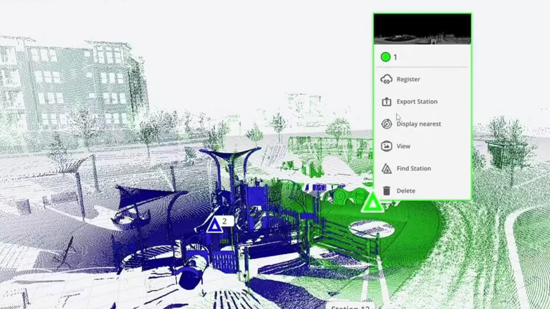
Trimble Perspective
Specifically designed for in-field control and complete registration when working with a Trimble X12 or X7 3D laser scanner system. Seamless integration with the Trimble® X12 and X7 3D laser scanners enables in-field automated registration, on-the-fly measurements and annotations. 3D visualization allows you to verify data before leaving the worksite.
-

T110
Boost your productivity in reality capture, survey and construction workflows with the high-performance Trimble® T110 tablet. Enjoy unmatched speed, seamless data flow and reliable, uninterrupted operation.
-

S5
Count on the Trimble S5 total station to make your job easier, day after day, project after project. Built on proven Trimble technologies––including Trimble SurePoint and MagDrive™ technology, and our DR Plus EDM.
-

S7
The Trimble S7 Total Station combines scanning, imaging and surveying into one powerful solution. Now you only need one instrument on the job site to perform all your data capture.
-

S9 /S9 HP
Whether your project involves monitoring, tunneling, or another highly specialized application, the Trimble S9 total station is the solution. It combines all of our top field technologies with our highest level of accuracy and our most advanced engineering features. The result is a high performance system built for the most demanding jobs.
-

SX12
With the NEW Trimble SX12 Scanning Total Station working harder has never been easier. It combines innovative technology with simple and intuitive functionality to help you save time, maximize efficiency and get more done in the field.
-

MX7
The Trimble MX7 Mobile Imaging System is a fast and cost effective way to manage assets such as bridges, buildings, roads, highways, and power stations, and document site conditions with geo-referenced images.
-

MX60
The Trimble® MX60 system is part of a complete field-to-finish mobile mapping solution that combines leading-edge hardware with intuitive field software and an integrated office software workflow.
-

MX90
The Trimble® MX90 system is part of a complete field-to-finish mobile mapping solution that combines leading-edge hardware with intuitive field software and an integrated office software workflow.