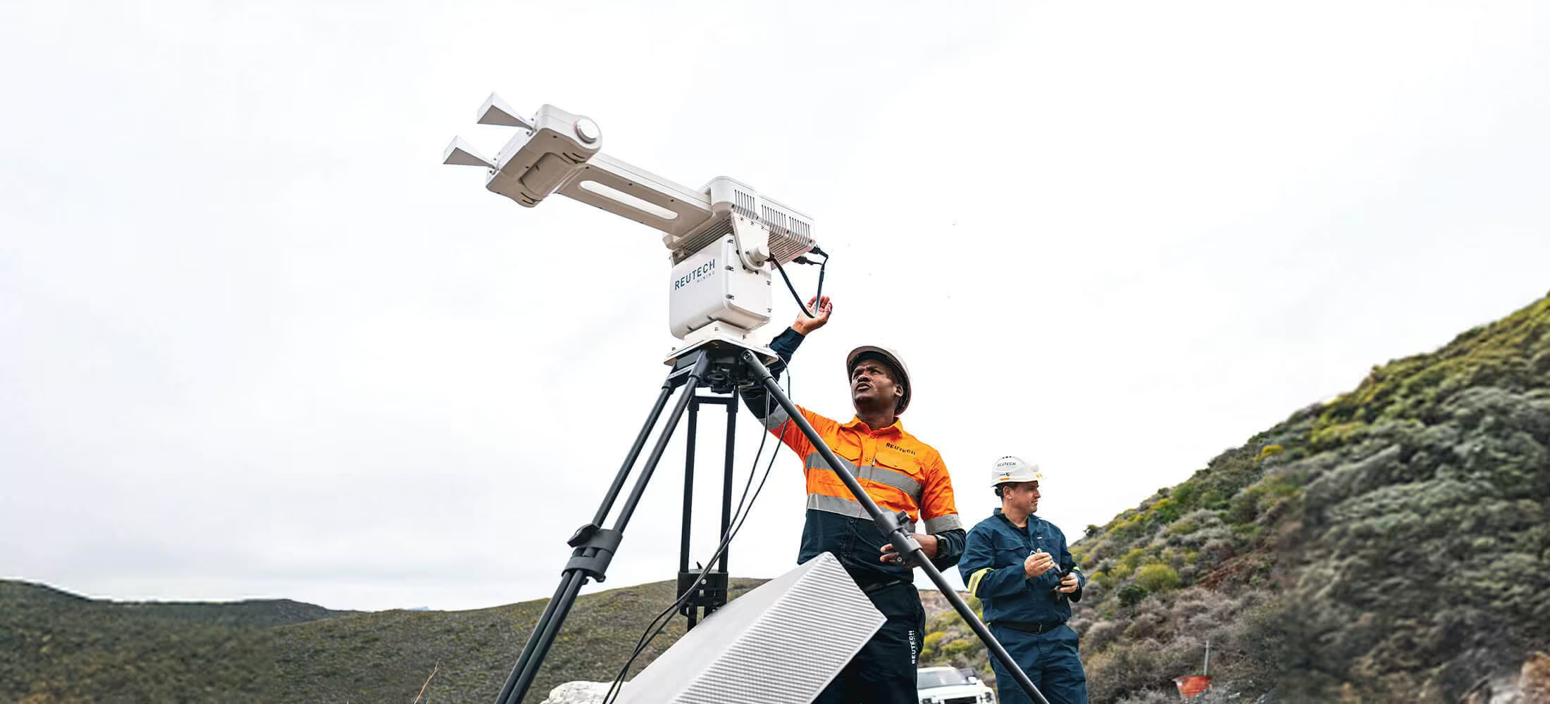
MSR Halo
Exceptional Coverage. Long range. High Resolution.
MSR Halo is Reutech Mining’s next-generation Synthetic Aperture Radar (SAR) system for slope stability monitoring. Delivering a complete 360° omnidirectional scan envelope at high speed and over extended ranges of up to 5,000 m, Halo sets a new standard in radar monitoring.
Need a Quote?
We’ll Call You
Simply enter your contact details and one of our specialists will call you to discuss your requirements and provide a detailed quotation.

Detect Micro-Movements Before They Become Risks
Designed for both tactical and strategic campaigns, the system provides exceptional spatial resolution to detect micro-deformational ground movements across slopes, tailings storage facilities, and natural hazards. Paired with the cloud-based MSR Halo software, it ensures complete accessibility, intuitive control, and advanced alarming capabilities. Critical insights are available anywhere, anytime – supporting faster, safer decisions for every operation.
Flexible 360° Coverage Across Any Geotechnical Environment
The Trimble R750 brings together advanced GNSS performance, secure connectivity, and field-ready durability in a compact, dependable system. Explore the key features that help surveyors work faster, stay connected, and deliver accurate results in any environment.
Need a Quote?
We’ll Call You
Simply enter your contact details and one of our specialists will call you to discuss your requirements and provide a detailed quotation.
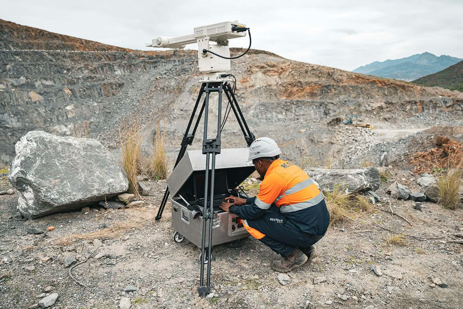
Fully Geo-referenced
Monitoring data is fully geo-referenced to the mine’s coordinate system, ensuring precise spatial correlation. This allows operators to view areas of interest accurately or export data into third-party software for further analysis and integration.
Long-Range, High-Resolution Monitoring
Halo combines an extended range of up to 5,000 m with excellent spatial resolution, enabling detection of subtle ground movements across large scan areas. This level of detail supports proactive slope management and tactical decision-making.
Deployment Options for Flexible Site Requirements
The system can be supplied in different configurations to meet operational needs.
Need a Quote?
We’ll Call You
Simply enter your contact details and one of our specialists will call you to discuss your requirements and provide a detailed quotation.
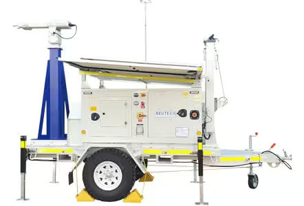
Trailer-based deployment
Mobile and ready for rapid deployment with an autonomous mobile power supply.
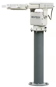
Fixed installation
Pillar-mounted with external power supply.
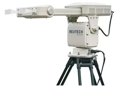
Portable deployment
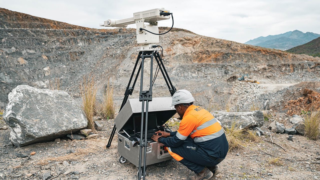
Tripod-mounted with a portable external power supply.
Precise, Reliable, and Ready for Any Environment
MSR Halo delivers sub-millimetre accuracy across a full 360° scan envelope, with ranges from 30 m up to 5,000 m. Rapid 1-minute scans, flexible connectivity options—including Wi-Fi, 4G/5G, and Starlink—and robust environmental tolerance ensure reliable performance in even the harshest conditions.
Need a Quote?
We’ll Call You
Simply enter your contact details and one of our specialists will call you to discuss your requirements and provide a detailed quotation.
-
Scan Envelope:
360° azimuth, 60° elevation
-
Scan Range:
30m – 5 000m
-
Communications:
Wi-Fi | 4G/5 G | Starlink
-
Scan Speed:
1 Minute
-
Accuracy:
Sub-millimetre
-
Spatial Resolution:
Range: 0.3 m | Azimuth: 5.1 m @ 1,000 m
-
Environmental Specifications:
Temperature: -30°C to +55°C | Wind: 110 km/h

Real-Time Insight, Wherever You Work
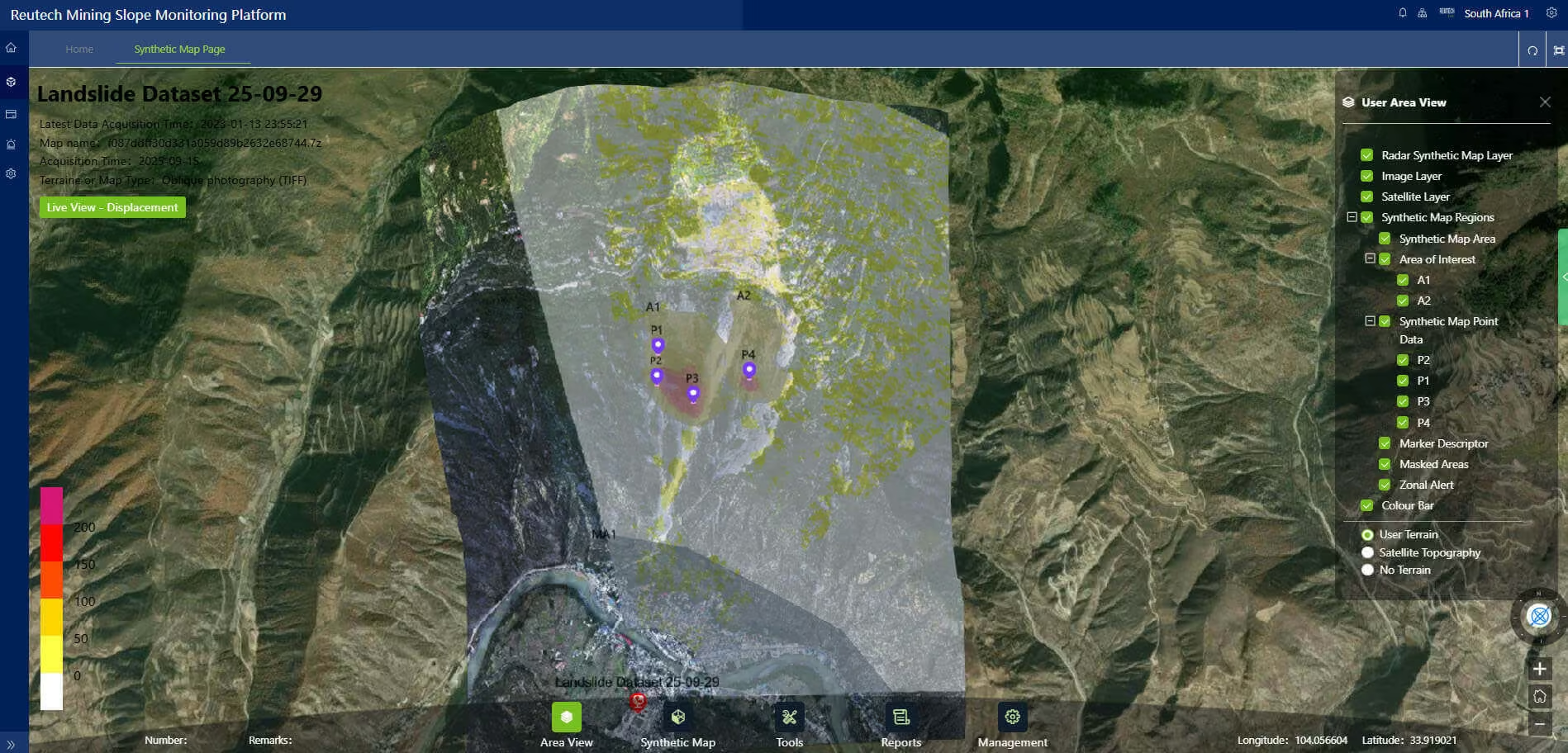
MSR Halo Software gives teams secure, real-time access to slope monitoring data from any location. Whether you are working on site, in the control room, or remotely, the platform makes it simple to configure alarms, visualise slope behaviour, and track performance with clarity and confidence.
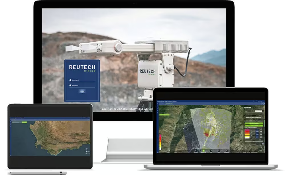
Designed with efficiency in mind, Halo Software is optimised for reliable operation even in low-bandwidth environments. This ensures continuous monitoring and timely responses, no matter the conditions.
The software focuses on one goal: to shorten the path from data to decision. With an intuitive interface, automated updates, and seamless access across devices, Halo Software equips operators to act faster, improve situational awareness, and strengthen both safety and productivity.
Key Benefits
Reliable access anywhere
Secure cloud-based access to your radar data, whether on-site, in the control room, or working remotely.
Real-time awareness
Immediate alarming and slope visualisation support faster, safer decision-making.
Intuitive interface
Clear and user-friendly design reduces complexity and shortens the path from data to action.
Resilient performance
Optimised for low-bandwidth conditions to ensure uninterrupted monitoring and insight.
Always up to date
Continuous updates maintain security, reliability, and future-ready performance.
Features That Enable Continuous, Reliable Monitoring
-
Cloud-based platform, accessible on any device.
-
Real-time alarm configuration and management.
-
Historical trend review and reporting.
-
Optimised for low-bandwidth operation.
-
Regularly updated to ensure uninterrupted monitoring.
See the MSR Halo in Action
Experience how MSR Halo delivers high-resolution monitoring and real-time insights across complex geotechnical environments. See how data, alarms, and visualisation come together to support faster, safer operational decisions.
Related Images


Need a Quote?
We’ll Call You
Simply enter your contact details and one of our specialists will call you to discuss your requirements and provide a detailed quotation.
-
 Effortless Mapping
Digital Compass
The RDC provides effortless mapping of Dip and Dip Direction, or Dip and Strike at the press of a button, and at any orientation or angle without needing to level the device. Information transfer from the device to a PC application is easily done via Bluetooth.
-
 Sub-Surface Profiler
SSP – Sub-Surface Profiler
Designed specifically for the challenges faced by underground mining operations globally, the SSP improves dynamic decision making through the precise management of Fall of Ground risks, as well as the optimal use of support mechanisms in an environment where every second counts.
-
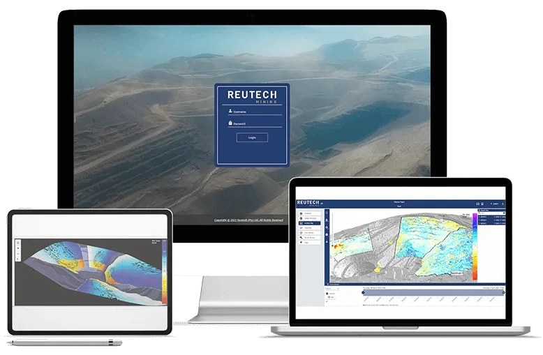 Monitoring Software
MSR Connect
This new ultra user-friendly software operates with accelerated high speed data acquisition and processing rates and combined with fast precision analytics, this allows for improved dynamic decision making capabilities.
-
 Evolutionary Geo-referenced Camera System
Slope Vision
The Slope Vision system comprising of a high-definition camera system and advanced software enables the user to command the camera to specific georeferenced coordinates or points of interest.
-
 Multi Purpose Platform
MPP-Multi Purpose Platform
Intended for going anywhere at any time, the MPP offers a mounting platform for a variety of different sensors and equipment. The platform has been designed with modularity in mind and can be configured for various user requirements.
-
 Modular Slope Monitoring Radar
MSR IV Esprit
As of its first release back in 2006 the renowned MSR earned a reputation of trust in the pit slope monitoring industry, providing the capability for both critical and strategic monitoring.