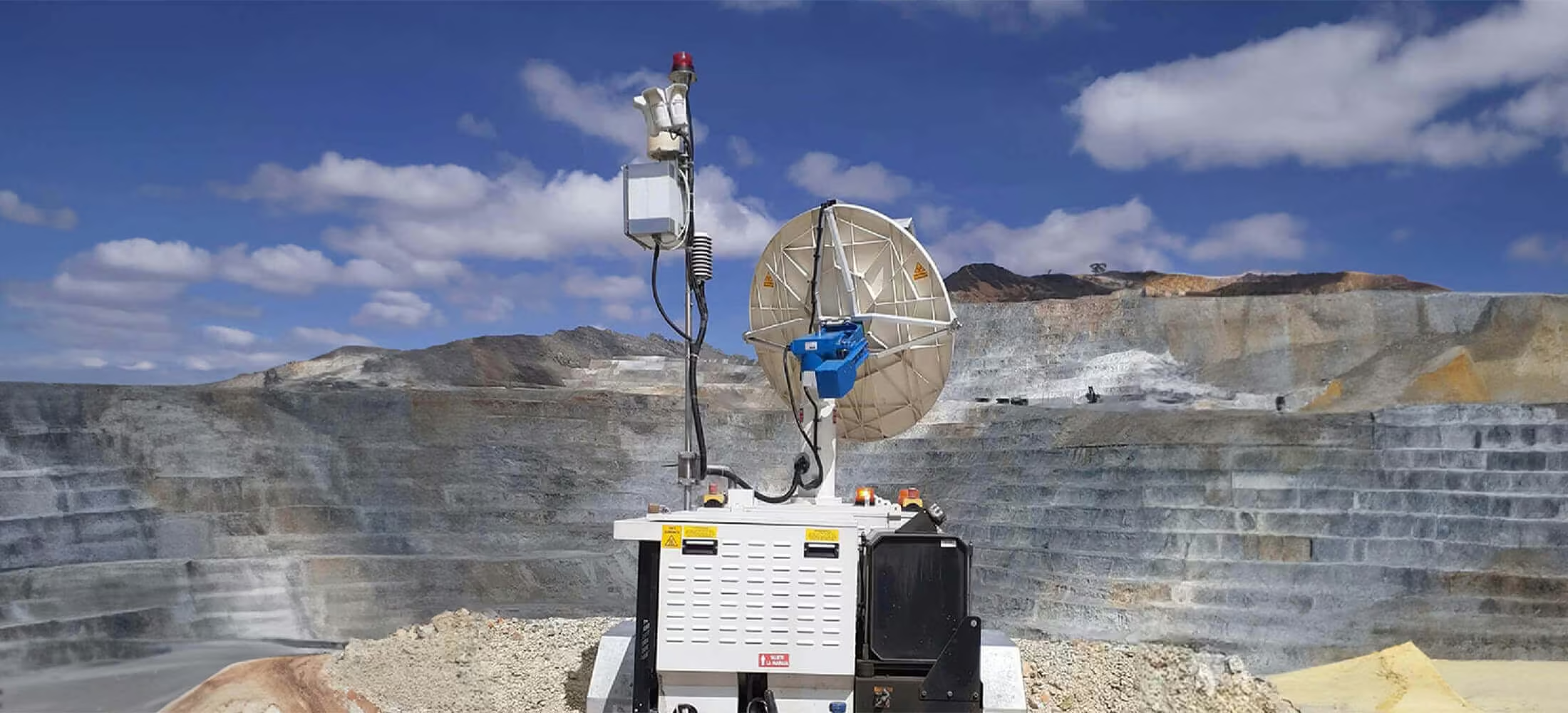
MSR Modular
Engineered with modularity in mind – The world’s most advanced slope monitoring radar for assessing the stability of mine walls, tailings dams and natural hazards.
Building on the innovative MSR Standard hardware platform, the MSR Modular offers all of the same benefits. The building blocks of the MSR Modular take flexibility to a whole new level, providing a highly customizable solution.
Need a Quote?
We’ll Call You
Simply enter your contact details and one of our specialists will call you to discuss your requirements and provide a detailed quotation.

A Scalable Monitoring Solution Built to Evolve
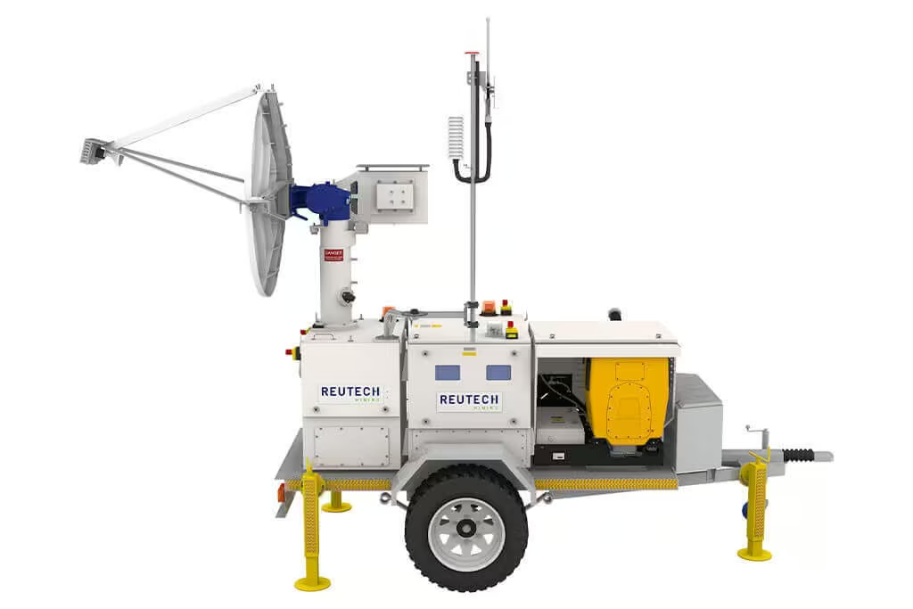
The Radar Module forms the foundation of the solution and can be supplied with electrical power to provide real time data at operating distances of up to 4000 meters. Intended to evolve with the requirements of operational and budgetary requirements, the MSR Modular allows for optional Battery, Generator and Solar Modules, all with a variety of mounting options.
Lifecycle costs are greatly reduced; with a new integrated power management system, drastically reducing the service requirements.
See Ground Movement as It Happens
MSR Modular delivers true real-time monitoring through rapid scanning, parallel data processing, and high-speed wireless communication. Advanced compression and onboard computing ensure immediate access to accurate slope movement data and alarms from any location, supporting faster decisions and improved operational safety.
Real Time Monitoring
With a maximum scan speed of 40° per second, the MSR Modular covers broad areas in only a few minutes. The advanced parallel computing architecture processes data while actively scanning.
Lossless data compression algorithms combined with high speed wireless communication hardware provides instant remote access. This means that slope movement information and alarms are immediately available.
Anywhere. In real time.
True 3D Data
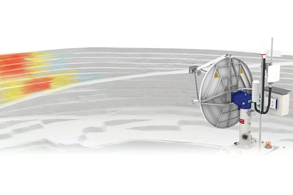
Unique to Real Aperture Radar technology, the MSR Modular produces its own a high resolution true 3-Dimensional point cloud. Each point is individually resolved in range, azimuth and elevation to the highest degree of accuracy.
The result is smaller failure mechanism tracking, without relying on Digital Terrain Models or camera images.
Exporting MSR Data
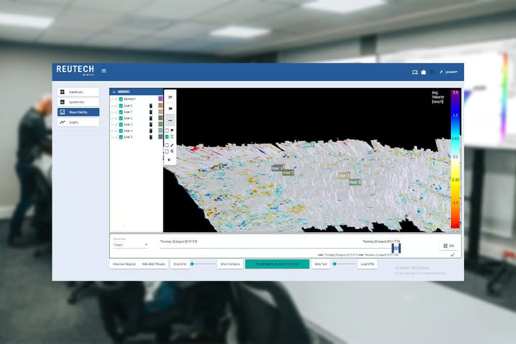
The MSR generates millions of 3-Dimensional surveyed data points. Each point is individually georeferenced and contains spatial and movement data which can be exported as a Digital Terrain Model or as a Comma Separated Value file.
That makes MSR data compatible with any third party mine planning and design software packages.

Integration
The MSR seamlessly interfaces with data from a variety of Automatic Total Station systems and extensometers.
Real time radar data is displayed along with color coded vectors that are scaled accordingly providing an integrated monitoring solution.
Environmental
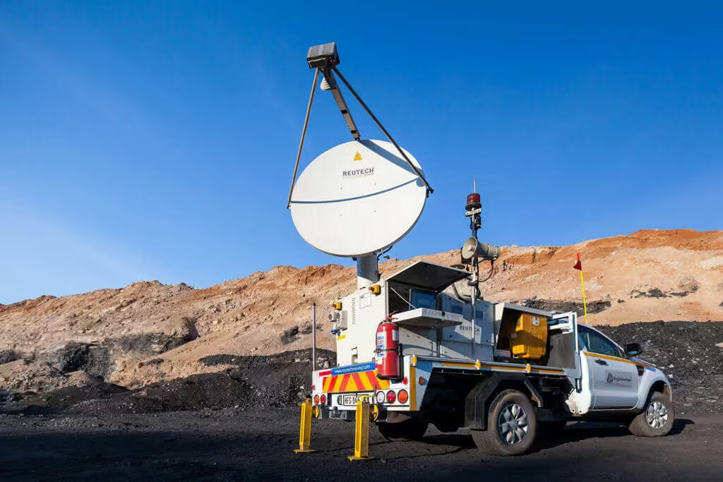
Designed and built by a company with its roots in the military defense industry, the MSR Series is engineered to reliably operate in the harshest of field conditions. The system can operate in high wind conditions, heavy rainfall events as well as in temperature extremes.
With next generation atmospheric correction algorithms the need for Known Stable regions are eliminated.
This means reliable radar data. Available when it’s needed most.
-
Temp Range: -30°C to +55°C
-
Low temperature kit: -50°C to +55°C
-
Relative humidity: 0% to 95%
-
Wind: up to 110 km/h
-
Rain: up to 60mm/h
Dynamic Decision Making
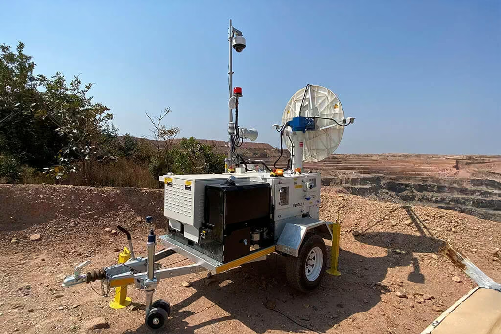
The MSR, with optimized onboard signal processing and high speed wireless communication capabilities, delivers geotechnical data and alarming functionality in real time.
This translates to a comprehensive understanding of slope stability performance in an environment where dynamic decision making ensures improved safety and increased productivity.
Optimized Mine Design
Because the initial pit design contains a variety of unknowns, the back analysis of past failures becomes imperative. With the MSR’s advanced data handling and storage capabilities, 3-Dimensional georeferenced movement and surveying data can be exported to a variety of third party mine planning software packages.
This means that the slope design can be constantly optimised as new knowledge of the underlying mechanics at play is unearthed.
Modular Building Blocks
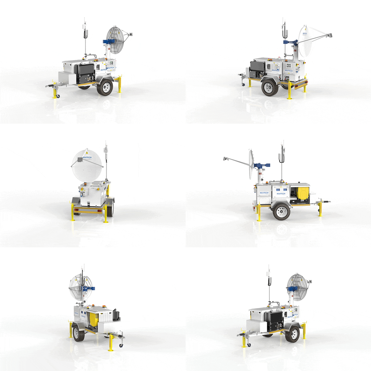
The MSR Modular’s configurable framework adapts easily to diverse mine conditions. Its modular building blocks provide flexibility without compromising accuracy or reliability. By combining rapid scanning speeds with advanced onboard processing, the system delivers real time slope stability information, enabling faster, more confident decision-making.
Need a Quote?
We’ll Call You
Simply enter your contact details and one of our specialists will call you to discuss your requirements and provide a detailed quotation.
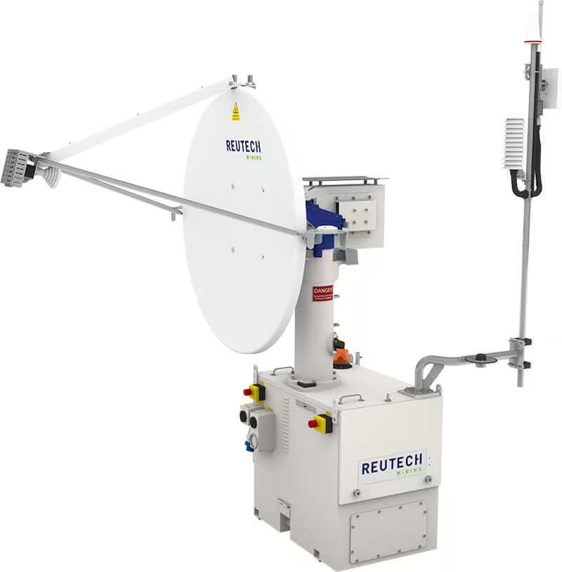
Radar Module
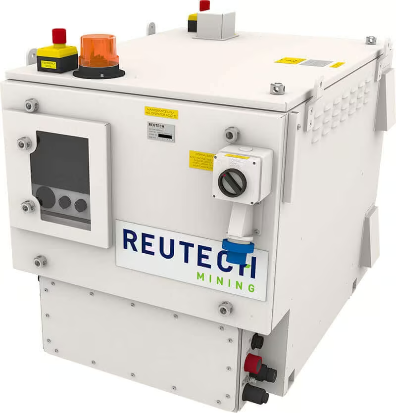
Battery Module
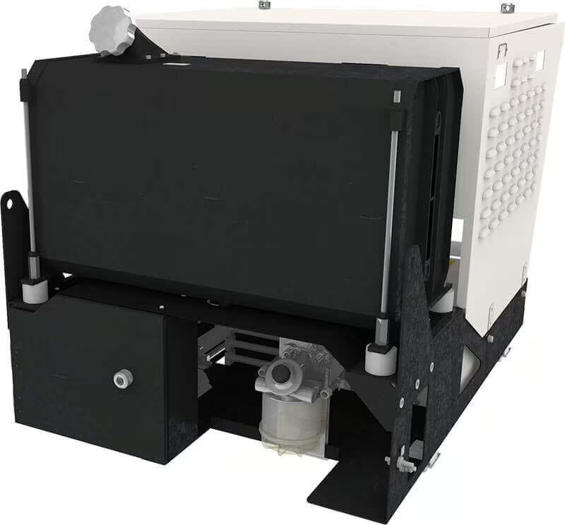
Generator Module
Engineered Hardware for Demanding Environments
MSR Modular hardware is purpose-built for accuracy, durability, and operational flexibility. From high-speed real aperture radar scanning to ruggedised internal systems and modular power options, every component is designed to perform reliably in harsh field conditions while delivering precise, georeferenced monitoring data.
-
Real Aperture Antenna
The next generation transceiver module is capable of transmitting and receiving radar signals every 6 milliseconds while continuously scanning at up to 40° per second. This means that multiple 3-Dimensional data points can be extracted from a single radar beam resulting in unrivalled data accuracy and reliability. With wide azimuth and elevation limits, the MSR offers high speed scanning over wide areas.
-
Georeferencing
The integrated Total Station along with securely mounted prisms provides for the highest level of accuracy when georeferencing the MSR
-
Internal Hardware
All internal hardware components have been carefully selected with standard operating temperatures within the -30°C to + 55°C range. This means that no additional heating or cooling elements are required dramatically improving power consumption as well as the overall reliability of the MSR.
-
Modular Design
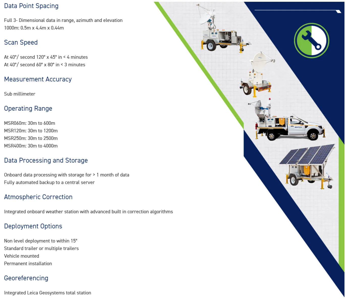
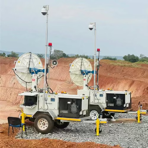
Intended to evolve with operational and budgetary requirements, the upgradeable Radar Module (to a maximum of 4000 metres) is the foundation of the MSR solution. Optional Battery, Generator and Solar modules; deployable as fixed, vehicle, single and multiple trailer configurations provide unmatched flexibility.
-
Non Level Deployment
Advanced onboard gyroscopes and patented algorithms makes the MSR the only radar system in the world that can be deployed and georeferenced in a non-level state to within -15° and +15° of pitch and roll.
-
Rugged Laptop
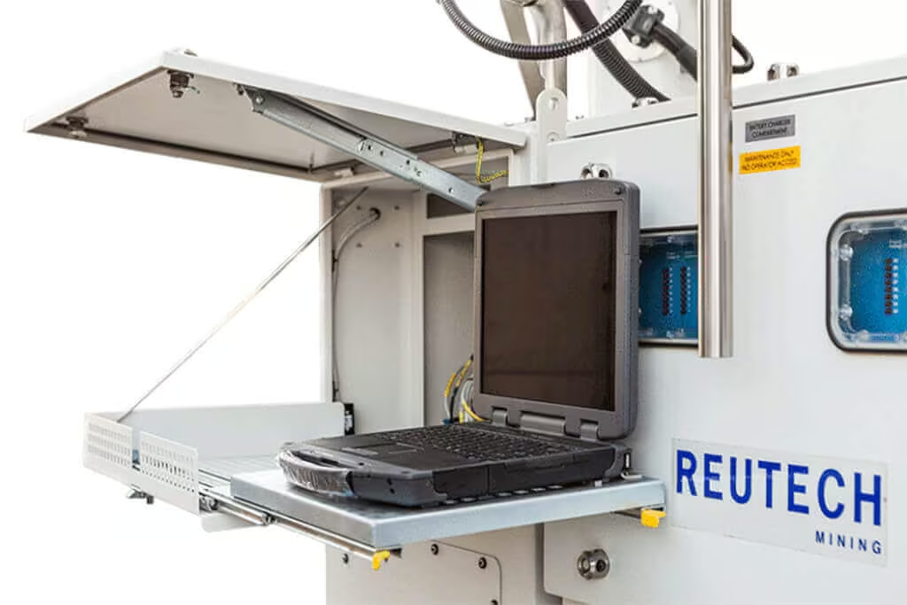
The internal rugged laptop provides a delicately refined user interface at every level. The internal 500 gigabyte Solid State Drive is resistant to shock and vibration and reliably stores up to 5 months of movement data. Fast data transfer rate allows for fully automated backups to a central server at user defined intervals and the automatic mounting of external storage devices further improves data portability. Complementing the extreme mobility of the MSR, an automatic power on/off sequence reduces the risk of data corruption during redeployment. With an easy to use keyboard and mouse interface as well as a 13.3” high visible-light intensity screen (600 nits), the rugged laptop can easily be operated in the harshest of conditions.
-
Power System
With enhanced power system management and improved generator control, the overall power consumption of the MSR is greatly reduced. The result is a 50% saving in system lifecycle costs through increased supply autonomy and reduced service intervals.
-
Trailer
The single axle MSR trailer allows for enhanced rotational manoeuvrability and effortless parking in space-constrained locations.
Performance Specifications You Can Rely On
| Technical Specifications | |
|---|---|
| Data Point Spacing | Full 3- Dimensional data in range, azimuth and elevation 1000m: 0.5m x 4.4m x 0.44m |
| Scan Speed | At 40°/ second 120° x 45° in < 4 minutes At 40°/ second 60° x 80° in < 3 minutes |
| Measurement Accuracy | Sub millimeter |
| Operating Range | MSR060m: 30m to 600m MSR120m: 30m to 1200m MSR250m: 30m to 2500m MSR400m: 30m to 4000m |
| Data Processing and Storage | Onboard data processing with storage for > 1 month of data Fully automated backup to a central server |
| Atmospheric Correction | Integrated onboard weather station with advanced built in correction algorithms |
| Deployment Options | Non level deployment to within 15° Standard trailer or multiple trailers Vehicle mounted Permanent installation |
| Georeferencing | Integrated Leica Geosystems total station |
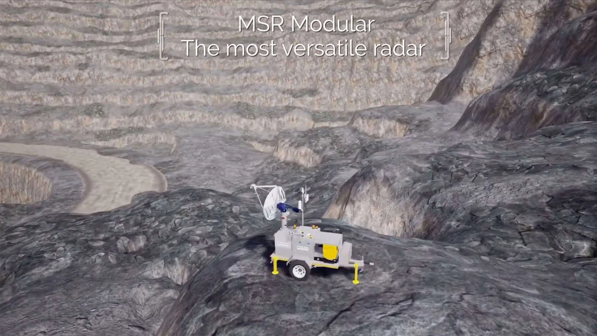
See the MSR Modular in Action
Discover how MSR Modular performs in live operational environments. See how real-time data, true 3D insights, and integrated alarming work together to support confident, informed decision-making on site and remotely.
Related Images


Need a Quote?
We’ll Call You
Simply enter your contact details and one of our specialists will call you to discuss your requirements and provide a detailed quotation.
-
 Effortless Mapping
Digital Compass
The RDC provides effortless mapping of Dip and Dip Direction, or Dip and Strike at the press of a button, and at any orientation or angle without needing to level the device. Information transfer from the device to a PC application is easily done via Bluetooth.
-
 Sub-Surface Profiler
SSP – Sub-Surface Profiler
Designed specifically for the challenges faced by underground mining operations globally, the SSP improves dynamic decision making through the precise management of Fall of Ground risks, as well as the optimal use of support mechanisms in an environment where every second counts.
-
 Monitoring Software
MSR Connect
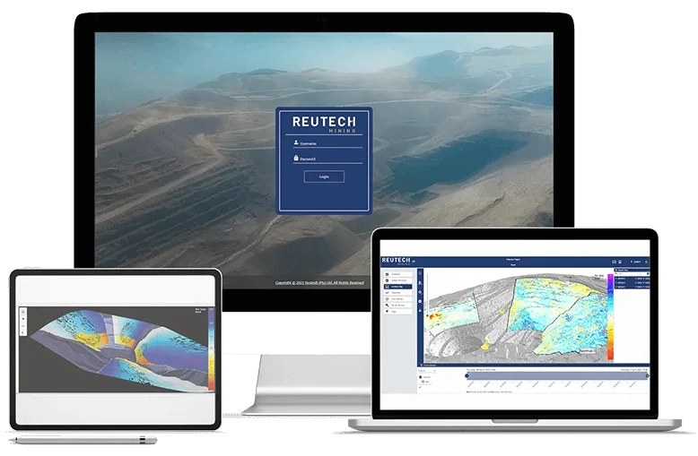
This new ultra user-friendly software operates with accelerated high speed data acquisition and processing rates and combined with fast precision analytics, this allows for improved dynamic decision making capabilities.
-
 Evolutionary Geo-referenced Camera System
Slope Vision
The Slope Vision system comprising of a high-definition camera system and advanced software enables the user to command the camera to specific georeferenced coordinates or points of interest.
-
 Multi Purpose Platform
MPP-Multi Purpose Platform
Intended for going anywhere at any time, the MPP offers a mounting platform for a variety of different sensors and equipment. The platform has been designed with modularity in mind and can be configured for various user requirements.
-
 Modular Slope Monitoring Radar
MSR IV Esprit
As of its first release back in 2006 the renowned MSR earned a reputation of trust in the pit slope monitoring industry, providing the capability for both critical and strategic monitoring.