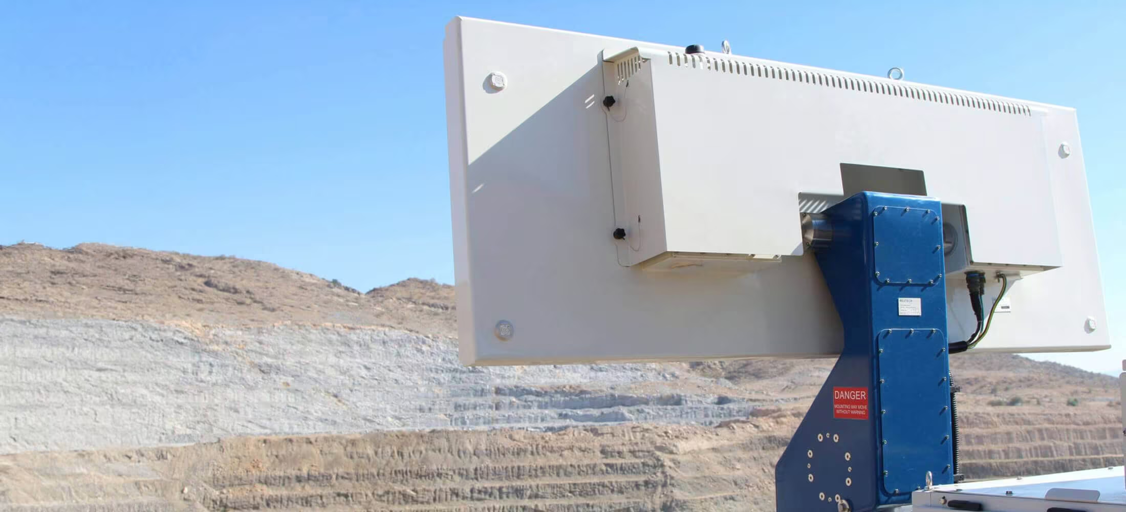
MSRIV Esprit
Radar solution for mines that struggle with rapidly changing atmospherics and fast moving slopes.
As of its first release back in 2006 the renowned MSR earned a reputation of trust in the pit slope monitoring industry, providing the capability for both critical and strategic monitoring.
Need a Quote?
We’ll Call You
Simply enter your contact details and one of our specialists will call you to discuss your requirements and provide a detailed quotation.

A Rugged, Intelligent Platform for Critical Mine Infrastructure
With advanced tamper-proof mechanisms, the MPP is purpose built for the most challenging of operational conditions with intelligent circuitry that ensures a reliable un-iterrupted power supply.
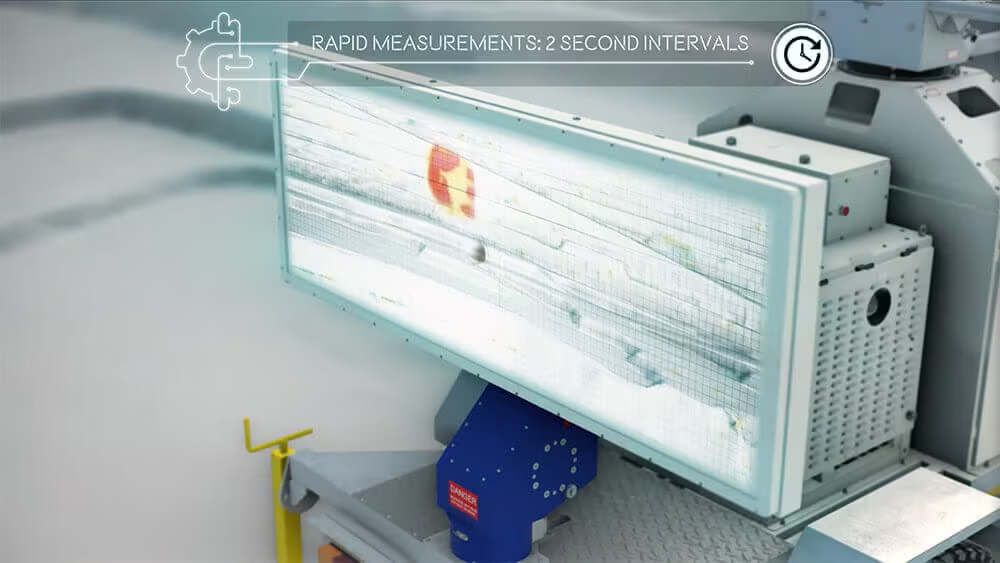
Scan Speed
2D measurements are taken in less than two seconds repetitively, nearly eliminating all the false movement measurements from atmospherics. The atmospheric changes in two seconds is minimal.
A high scan speed produces the truest data, there is almost no compensation required for false movement due to atmospherics. Therefore, an insignificant amount of data is lost in processing to eliminate noise.
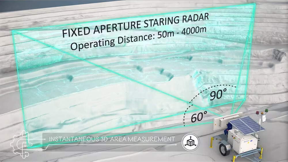
Instantaneous 2D Area Measurement
A whole area is scanned instantaneously in 2D with defined 3D synthetic map updates at pre-set intervals.
This ensures that environmental changes will not introduce the potential for unreliable measurements.
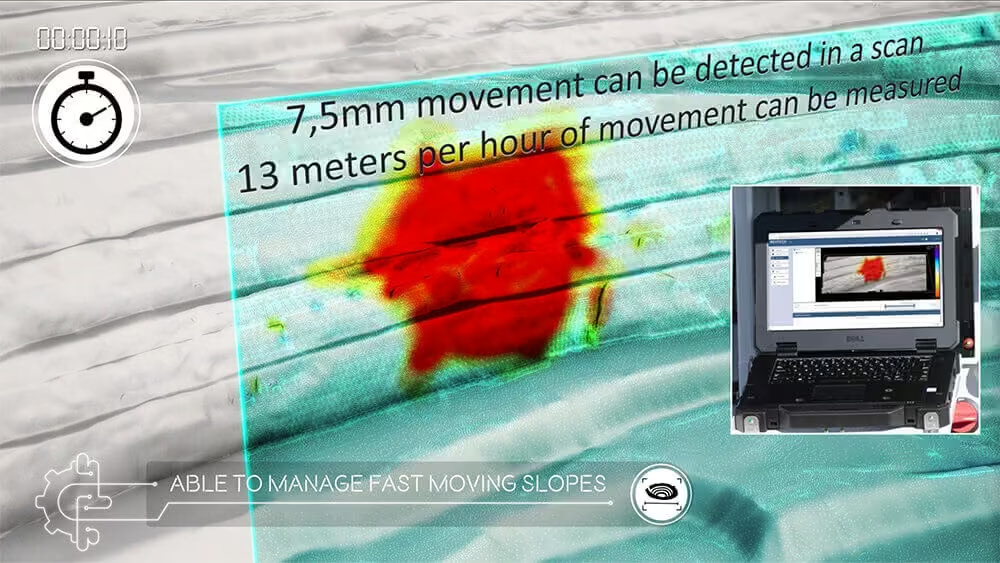
Critical and Strategic Monitoring
Critical monitoring: the high scan speed and instantaneous 2D area measurements detect rapid failures up to a rate of 13 500 mm/h effortlessly.
Strategic monitoring: due to the minute noise and interference, small scale movement is now easily detected. This results in predicting potential failures earlier and increasing warning times.
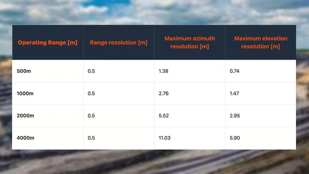
Resolution
The distance of the system from the pit slope, and therefore the point spacing generated for the synthetic map is paramount for defining the longitude and precision of resolution for which alarm settings are based.
The finer the precision and therefore the resolution, the more refined the displacement trend data will be for smaller detectable areas.
MSRIV Esprit offers an operating range up to 4 000 m, providing resolution options that are exceptional.
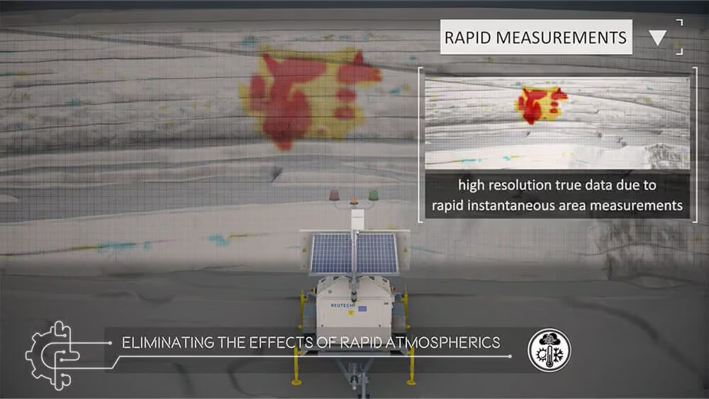
Moving Targets
This feature provides better coverage for working and production areas.
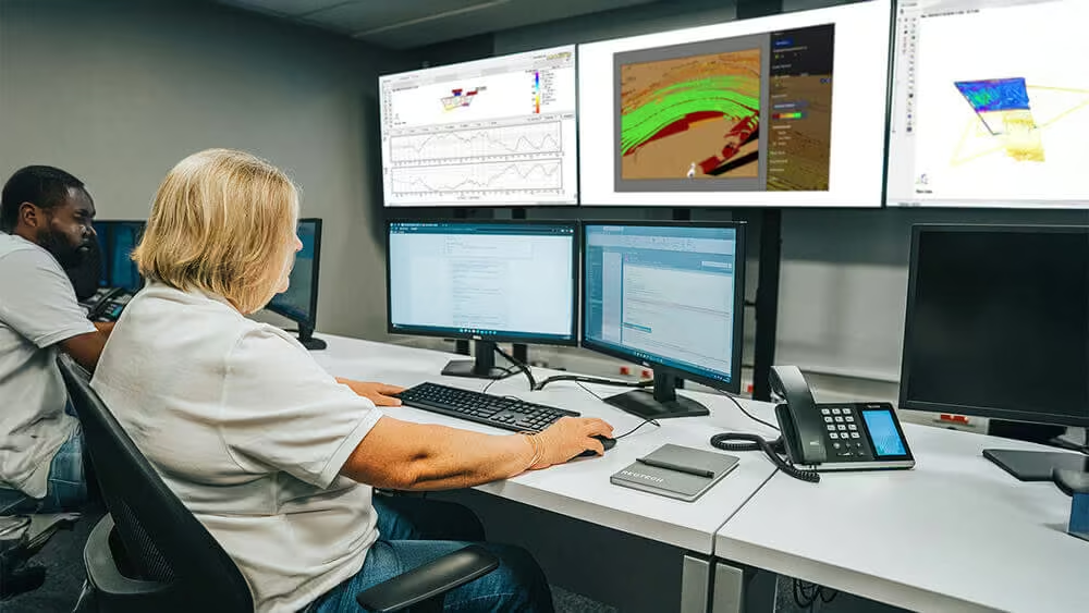
Software
-
MSRIV Esprit has the most advanced slope monitoring radar software on the market.
-
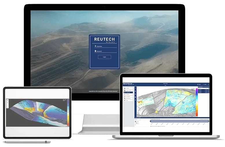
360° view: view multiple radars’ data on a 360° 3D scene with trends plots simultaneously.
-
Cross platform: the advanced web based software can be viewed on various platforms such as laptops, cell phones and tablets.
-
The software can run on Windows, Linux, Android and iOS.
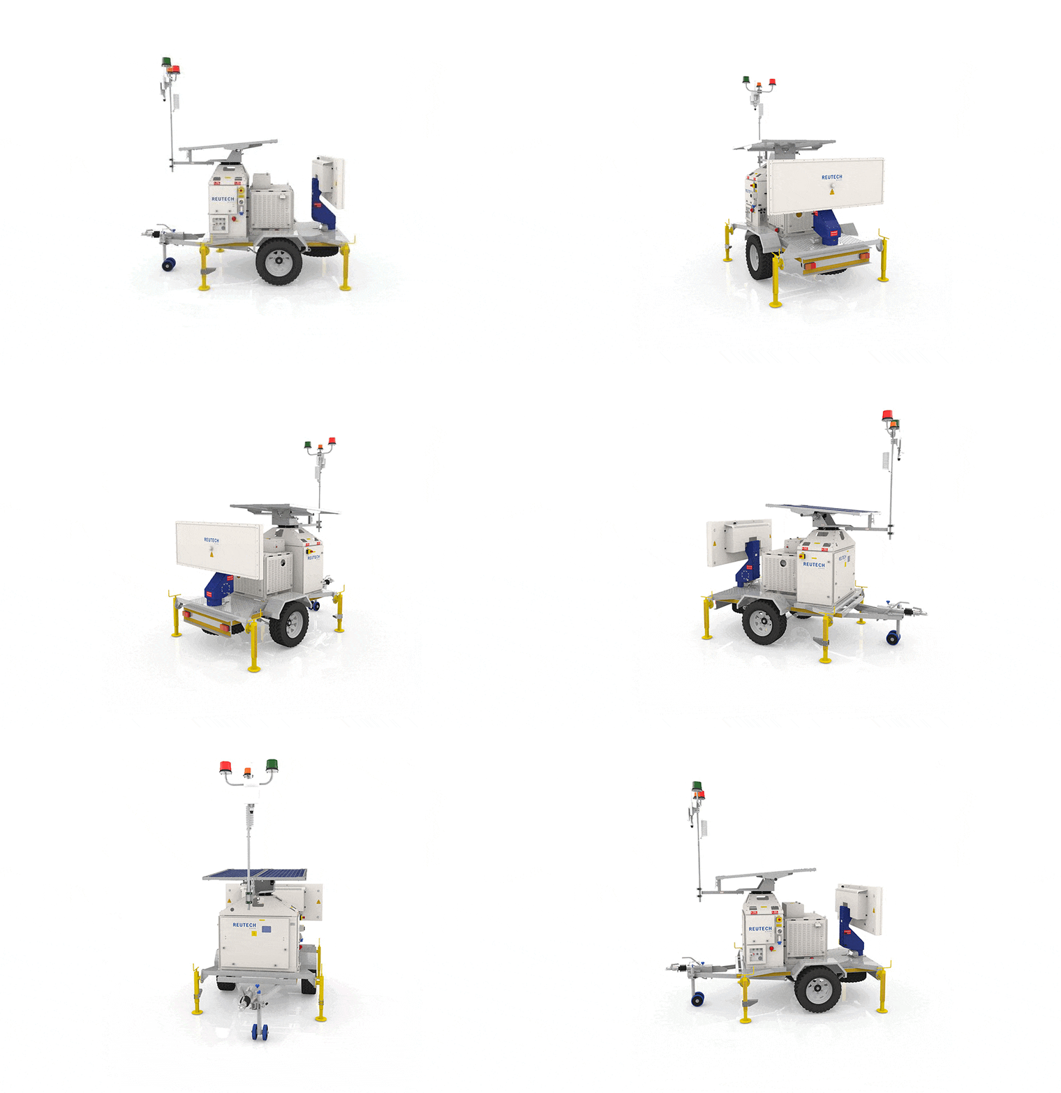
Integrated Hardware Built for Field Performance
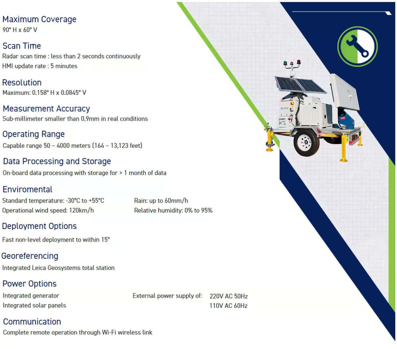
MSRIV Esprit integrates advanced radar hardware, intelligent power systems, and on-board processing into a single, robust solution. Each component is engineered to work seamlessly together, delivering reliable real-time monitoring, clear operator control, and dependable performance in demanding operational environments.
-
3D Proprietary MIMO Antenna Array
-
Antenna Positioner
-
Generator module
-
HMI Cabinet and Control Panel
-
On board laptop
-
Solar Panels
-
Solar Panels
-
WiFi & Weather Station
-
In-pit Alarm System
Performance Specifications You Can Rely On
| Technical Specifications | |
|---|---|
| Maximum Coverage | 90° H x 60° V |
| Scan Time | Radar scan time : less than 2 seconds continuously HMI update rate : 5 minutes |
| Resolution | Maximum: 0.158° H x 0.0845° V |
| Measurement Accuracy | Sub-millimeter smaller than 0.9mm in real conditions |
| Operating Range | Capable range 50 – 4000 meters (164 – 13,123 feet) |
| Data Processing and Storage | On-board data processing with storage for > 1 month of data |
| Deployment Options | Non level deployment to within 15° Standard trailer or multiple trailers Vehicle mounted Permanent installation |
| Enviromental | Standard temperature: -30°C to +55°C Operational wind speed: 120km/h Rain: up to 60mm/h Relative humidity: 0% to 95% |
| Deployment Options | Fast non-level deployment to within 15° |
| Georeferencing | Integrated Leica Geosystems total station |
| Power Options | Integrated generator Integrated solar panels External power supply of: 220V AC 50Hz 110V AC 60Hz |
| Communication | Complete remote operation through Wi-Fi wireless link |
See the MSR IV Esprit in Action
Explore the MSR IV Esprit in real-world conditions. Watch how the system delivers precise monitoring, rapid deployment, and reliable performance across challenging mining environments.

Related Images


Need a Quote?
We’ll Call You
Simply enter your contact details and one of our specialists will call you to discuss your requirements and provide a detailed quotation.
-
 Effortless Mapping
Digital Compass
The RDC provides effortless mapping of Dip and Dip Direction, or Dip and Strike at the press of a button, and at any orientation or angle without needing to level the device. Information transfer from the device to a PC application is easily done via Bluetooth.
-
 Sub-Surface Profiler
SSP – Sub-Surface Profiler
Designed specifically for the challenges faced by underground mining operations globally, the SSP improves dynamic decision making through the precise management of Fall of Ground risks, as well as the optimal use of support mechanisms in an environment where every second counts.
-
 Monitoring Software
MSR Connect
This new ultra user-friendly software operates with accelerated high speed data acquisition and processing rates and combined with fast precision analytics, this allows for improved dynamic decision making capabilities.
-
 Evolutionary Geo-referenced Camera System
Slope Vision
The Slope Vision system comprising of a high-definition camera system and advanced software enables the user to command the camera to specific georeferenced coordinates or points of interest.
-
 Multi Purpose Platform
MPP-Multi Purpose Platform
Intended for going anywhere at any time, the MPP offers a mounting platform for a variety of different sensors and equipment. The platform has been designed with modularity in mind and can be configured for various user requirements.
-
 Modular Slope Monitoring Radar
MSR Modular
Building on the innovative MSR Standard hardware platform, the MSR Modular offers all of the same benefits. The building blocks of the MSR Modular take flexibility to a whole new level, providing a highly customizable solution.