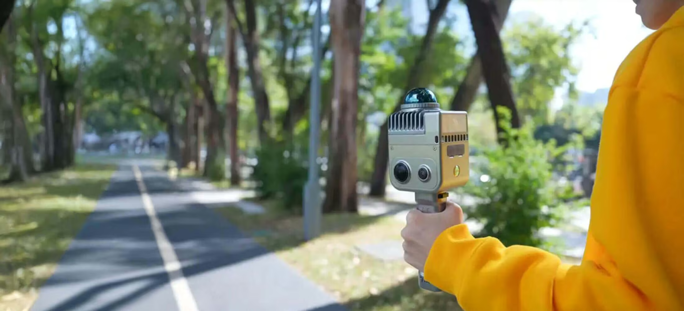
LixelKity K1
Compact handheld scanning and modelling device
Need a Quote?
We’ll Call You
Simply enter your contact details and one of our specialists will call you to discuss your requirements and provide a detailed quotation.
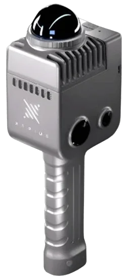
Lightweight, Rugged, and Ready to Scan
With a 1kg body, it integrates modules such as vision, LiDAR, inertial navigation and high-performance computing. Rated IP54 protection, it handles operations with ease.
Panoramic Camera
-
2x 48MP cameras
-
360×360 True Panorama
-
Simple Link Sharing
-
Close Deals Faster
LiDAR
-
200,000 points / second
-
1.2cm Accuracy
-
40m Scanning distance
-
360° horizontal FOV
Battery
-
Fast-lock: magnetic buckle
-
1.5hr Battery
Easy to Use
-
Pick it up, walk, and scan
-
3D modelling is as simple as taking a stroll.
Real-time Modelling, Vivid Reconstruction
The combination of laser point clouds and 2x 48MP imagery allows the device to generate rich-coloured, finely detailed 3D point cloud models in real-time.
Upgraded Multi-SLAM , Stable Capture
Multi-sensor data fusion, including laser, vision, and GNSS data ensures stable scanning with enhanced scene adaptability.
Unlock the Cyber World
Professional-grade performance at a consumer-level price.
Industry Applications Across Multiple Sectors
The LixelKity K1 handheld scanner delivers versatile 3D capture performance for a wide range of professional use cases. From accurate real estate surveying and robust digital twin creation to immersive media and gaming environments and cultural and tourism digitisation, it adapts to workflows where portability, precision, and real-time modelling matter most.
Need a Quote?
We’ll Call You
Simply enter your contact details and one of our specialists will call you to discuss your requirements and provide a detailed quotation.

Real Estate Surveying
Capture accurate spatial data quickly and efficiently. LixelKity K1 enables fast interior and exterior scans, delivering reliable measurements and 3D models to support planning, documentation, and property analysis.

Digital Twins
Create detailed digital twins with real-time point cloud visualisation. LixelKity K1 simplifies spatial data capture for ongoing monitoring, asset management, and virtual simulations across built environments.

Media & Gaming
Scan real-world locations and turn them into usable 3D assets. LixelKity K1 supports immersive environment creation for games, visual effects, and interactive media with minimal post-processing.

Culture & Tourism
Digitise cultural sites and landmarks with speed and precision. LixelKity K1 helps preserve spaces digitally while enabling virtual tours and immersive visitor experiences for broader access and engagement.
Practical Solutions for Real-World Surveying
LixelKity K1 delivers fast, accurate spatial data across a wide range of surveying and mapping applications. From large-area terrain capture to smart infrastructure planning, it supports efficient fieldwork and dependable results where precision matters.

Topographical Mapping
Capture terrain and elevation data quickly with high-density point clouds, supporting accurate mapping, planning, and land analysis.

Agricultural & Forestry Survey
Efficiently document fields, crops, and forest environments with portable scanning that delivers reliable spatial insights for management and monitoring.

Smart City
Collect detailed 3D data for urban infrastructure, supporting planning, asset management, and data-driven city development.

Engineering Survey
Perform precise site surveys and as-built documentation with real-time visualisation to support design, construction, and validation workflows.
See the LixelKity K1 in Action
Watch how LixelKity K1 captures accurate 3D spatial data in real time, enabling fast and efficient handheld scanning across diverse environments.
Related Images


Need a Quote?
We’ll Call You
Simply enter your contact details and one of our specialists will call you to discuss your requirements and provide a detailed quotation.
-

PortalCam
PortalCam captures real spaces as photorealistic 3D worlds. Powered by 3D Gaussian Splatting, PortalCam turns any location into interactive spatial models you can walk through, edit, and share. -

Lixel CyberColor
Create ultra-realistic large-scale environments and immersive experiences instantly, across multiple devices.
