eCognition
Transform Geospatial Data into Meaningful Information
Trimble eCognition enables you to accelerate and automate the interpretation of your geospatial data products by allowing you to design your own feature extraction and change detection solutions.
Need a Quote?
We’ll Call You
Simply enter your contact details and one of our specialists will call you to discuss your requirements and provide a detailed quotation.
Need a Quote?
We’ll Call You
Simply enter your contact details and one of our specialists will call you to discuss your requirements and provide a detailed quotation.

Automated geospatial insights powered by object-based image analysis
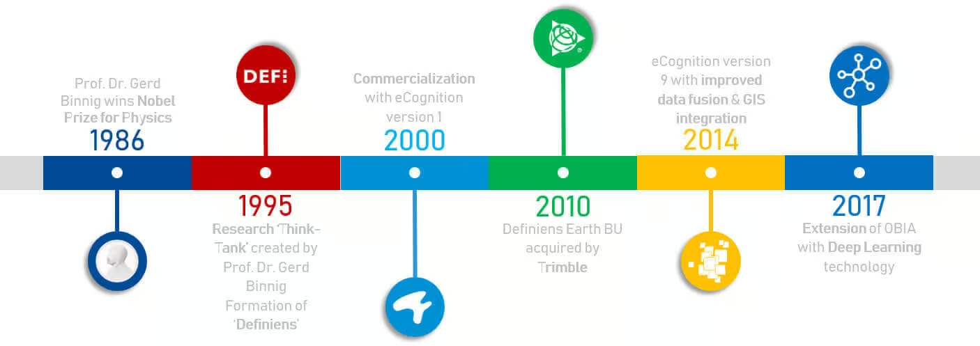
Trimble eCognition is a powerful remote sensing software designed to accelerate and automate the interpretation of geospatial data. With over 20 years of innovation, eCognition enables users to build custom feature extraction and change detection workflows — turning complex datasets into actionable insights.
Whether you’re a GIS professional, remote sensing expert, or data scientist, Trimble eCognition software helps you automate geospatial data analytics with advanced object-based image analysis and data fusion capabilities.
Whether you’re a GIS professional, remote sensing expert, or data scientist, Trimble eCognition software helps you automate geospatial data analytics with advanced object-based image analysis and data fusion capabilities.
Object-Based image analysis that thinks like a human analyst
The meaning of eCognition lies in its name. It represents electronic cognition, or the ability of a system to “think” like a human analyst. eCognition software examines pixels, points, and vectors not in isolation, but in context, identifying relationships, textures, shapes, and colors to derive intelligent conclusions.
This object-based image analysis approach allows Trimble eCognition to emulate cognitive reasoning, recognizing patterns, classifying features, and fusing multiple data types to deliver consistent, automated, and repeatable results.
Driven by Object-Based Analysis
Unlike conventional pixel-based tools, eCognition interprets geospatial data holistically. Its patented segmentation and classification technology mimics human cognitive processes by analyzing contextual relationships between objects.
By understanding not just what is in the data but how it relates to surrounding features, Trimble eCognition delivers more accurate, meaningful, and scalable results for complex geospatial projects.
The technology examines pixels/ points not in isolation, but in context. It builds up a picture iteratively, recognizing groups of pixels as objects. Just like the human mind, it uses the colour, shape, texture and size of objects as well as their context and relationships to draw the same conclusions and inferences as an experienced analyst, but adding the advantages of automation and standardization. Though somewhat simplified, the following example illustrates the basic principles.
With the addition of a knife and fork, the circle is immediately recognized and classified as a plate. The circular object hasn’t changed, but the human mind uses context and relationships with other objects to make intelligent inferences about the objects it perceives. And this is precisely how eCognition works.
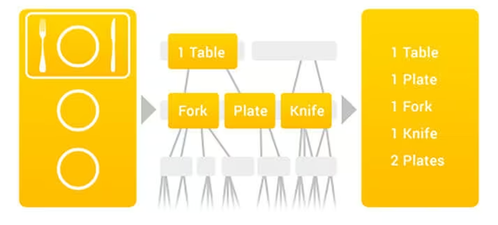
Dynamic and Intelligent Analysi
Through iterative segmentation and classification, users can create detailed rule sets or customized applications that translate expert interpretation into automated, computer-readable logic and improving efficiency and data consistency.
Data Fusion for Enhanced Insight
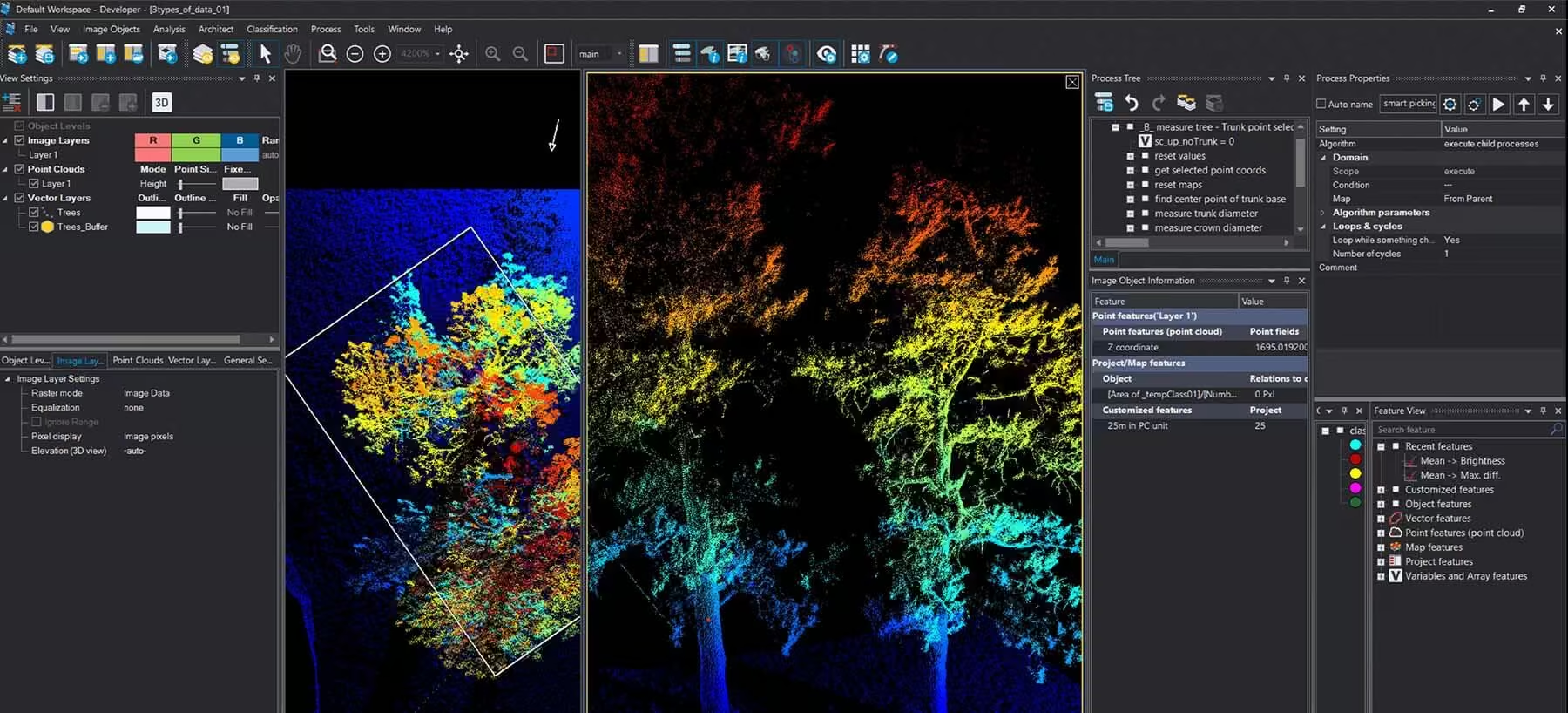
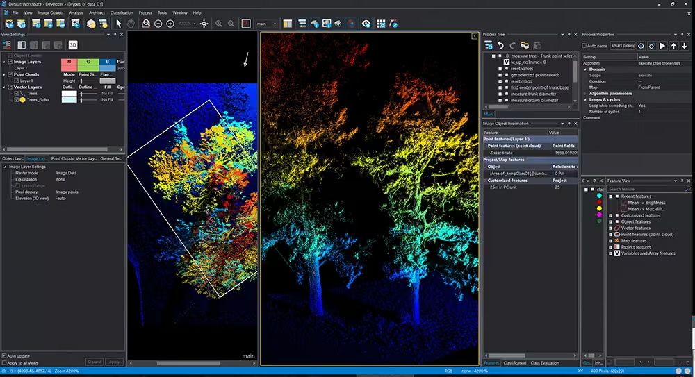
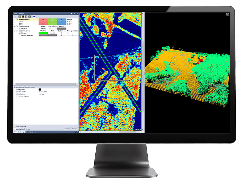
Trimble eCognition can fuse a variety of data formats, from spectral raster and 3D point clouds to thematic GIS vector layers. This allows imagery, vectors, and point clouds to interact, providing a complete and cohesive analysis environment.
By leveraging the full power of multi-source data, eCognition software ensures that every layer of geospatial information contributes to accurate, actionable intelligence.
Transform Geospatial Data Into Actionable Information
Trimble eCognition is an advanced analysis software for geospatial applications.
It is designed to improve, accelerate and automate the interpretation of a variety of geospatial data and enables users to design feature extraction of change detection solutions to transform geo-data into to geo-information.
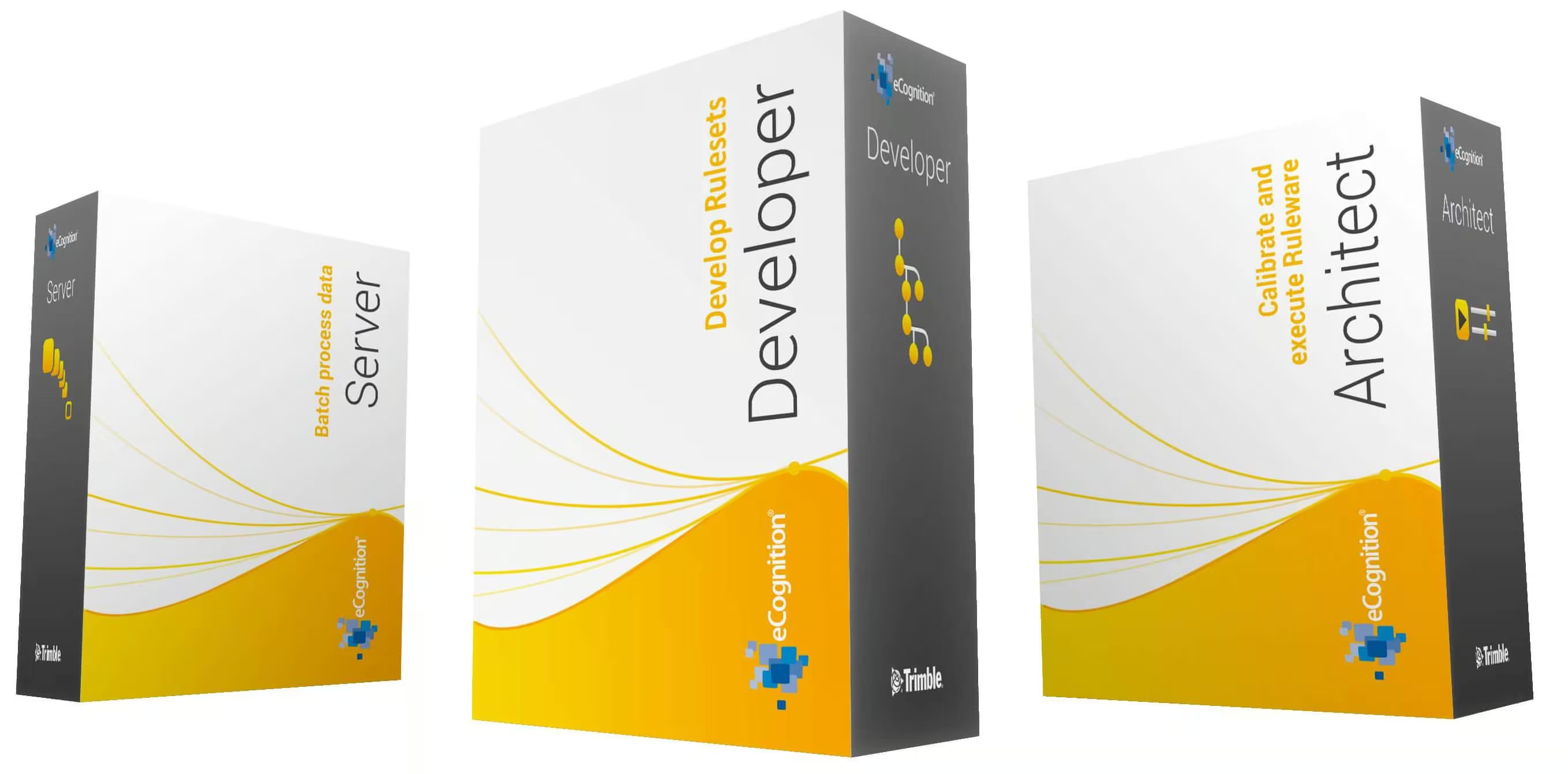
The eCognition Suite offers three different components which can be used stand-alone or in combination to solve even the most challenging image analysis tasks.
The eCognition Software Suite
The eCognition suite includes three integrated components designed to support every stage of geospatial analysis, from rule set development to enterprise-scale processing.
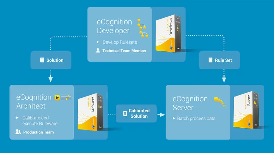

eCognition Developer
A robust development environment for building rule sets and image analysis workflows. Ideal for scientists, researchers, and GIS professionals.
Features & Benefits:
-
Advanced object-based image analysis tools
-
Works with raster, vector, and point cloud data
-
Intuitive interface with QuickMap & Developer modes
-
Scalable from single desktop use to enterprise solutions
-
SDK and online rule set resources for custom development

eCognition Architect
A simplified platform that brings eCognition power to non-technical professionals such as urban planners, foresters, or vegetation analysts.
Features & Benefits:
-
Easy access to object-based image analysis
-
Click-and-classify toolbox for streamlined workflows
-
Scalable from individual to enterprise processing
-
Guided workflows for intuitive setup and execution
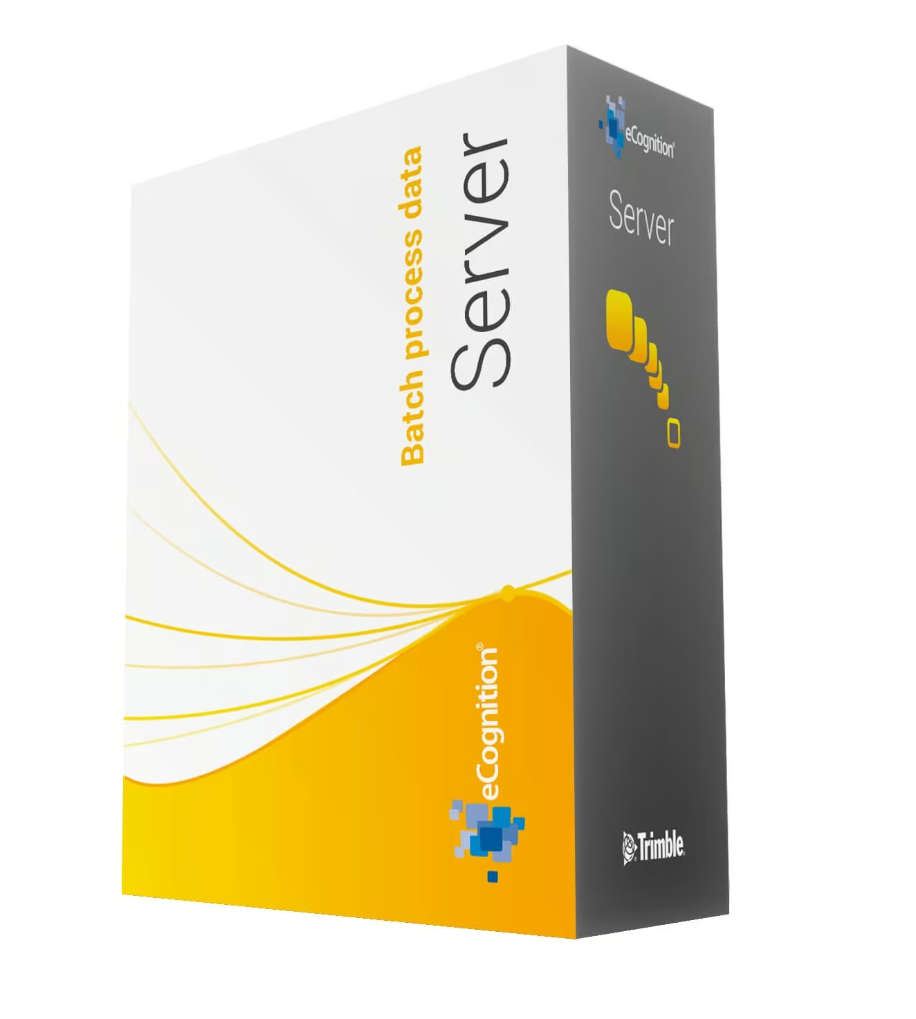
eCognition Server
An enterprise-grade processing solution for large-scale geospatial analysis. Designed to automate thousands of images or datasets in a single run.
Features & Benefits:
-
High-performance batch processing
-
Grid-based architecture for scalability
-
Integration with ArcGIS and API workflows
-
Full administrative control and monitoring tools
Why Choose Trimble eCognition?
-
Proven object-based image analysis technology
-
Automates complex geospatial data interpretation
-
Combines AI, ML, and contextual reasoning
-
Scalable solutions for research, commercial, and government use
-
Backed by Trimble innovation and global support
See the Trimble eCognition in Action
Experience how Trimble eCognition transforms complex geospatial data into clear, actionable insights through automated analysis and intelligent feature extraction.
Related Images


Need a Quote?
We’ll Call You
Simply enter your contact details and one of our specialists will call you to discuss your requirements and provide a detailed quotation.
-

Trimble RealWorks
Automated tools and point cloud workflows help users quickly process, analyze and create high-quality deliverables. -

Trimble Mine Insights
Optimise your surveying, drilling, blasting and geotechnical workflows with Trimble® Mine Insights™ software, a cloud-based mining analytics application. -

Inpho UAS Master
Create powerful deliverables from images collected with UAS (Unmanned Aircraft Systems) aerial mapping and surveying systems. -

Inpho
Inpho office software transforms aerial images into accurate point clouds, surface models and orthophoto mosaics. -

Trimble MX Office Software
Mobile mapping operations collect massive data sets very quickly. It is important to have the right software tools to simplify data organization, feature extraction, and customer collaboration. -

Applanix POSPac MMS
POSPac Mobile Mapping Suite, now with Trimble CenterPoint RTX, is an industry leading GNSS-Aided Inertial post-processing software -

Terra Office
Trimble Terra Office software helps professionals manage high-accuracy TerraFlex data and integrate it into GIS systems. -

Trimble Sentinel
The Trimble® Sentinel device tracking solution is the easy way to quickly track total stations using your mobile device in real time. -

Trimble Reality Capture Platform
The Trimble® Reality Capture platform service enables users to collaborate, share, store and manage large amounts of reality capture data in the cloud. -
Trimble Connect
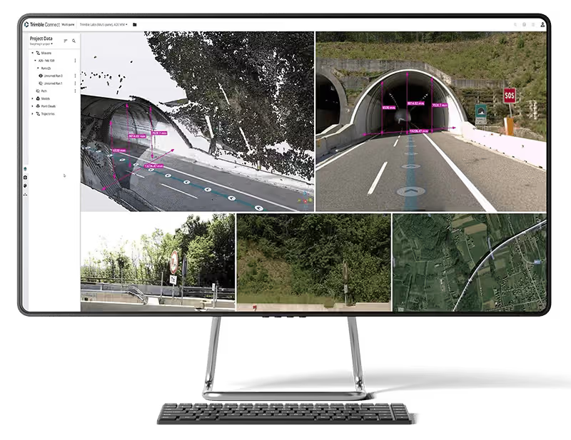
Trimble Connect is a cloud-based platform that connects teams with the right data at the right time. -

Trimble Business Center
Trimble Business Center (TBC) software transforms field data into high-quality, actionable information and deliverables.